
Listing Graham, Marilyn Elevation 699 m | OS grid NH457222 Prominence 234 m | |
 | ||
Topo map OS Landranger 26, OS Explorer 416 Similar Falls of Foyers, Corrimony Chambered Cairn, Nessieland, Falls of Divach, Loch Ness Centre & Exhibition | ||
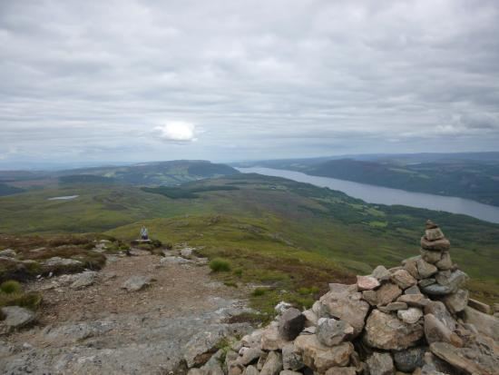
Meall Fuar-mhonaidh is a hill on the west side of Loch Ness, in the Highlands of Scotland. At 699 m in height, it is listed as a Graham and a Marilyn.
Map of Meall Fuar-mhonaidh, Inverness, UK
Its rounded shape and prominent position make it a distinctive landmark, visible from along much of Loch Ness.
Meall Fuar-mhonaidh is usually climbed from Grotaig, a hamlet at the end of minor road to the south-west of Drumnadrochit. From there a footpath passes through woods, then out onto moorland. This path climbs south-west along the ridge of Meall Fuar-mhonaidh to the summit.
References
Meall Fuar-mhonaidh Wikipedia(Text) CC BY-SA