
 | ||
Restaurants Santorini Pizza & Pasta, Tubs Gourmet Sub Sand, Manna Teriyaki, Wendy's, Luciano's Pizza & Pasta | ||
Meadowbrook is a neighborhood in the Lake City district (township annexed in 1954) of Seattle, Washington. Meadowbrook is centered on open fields adjacent to the Meadowbrook Community Center, swimming pool, and Nathan Hale High School. It is bounded on the south by NE 95th Street and the Wedgwood neighborhood, on the north by NE 120th Street and Cedar Park, on the west by Lake City Way NE (State Route 522–SR 522) and Victory Heights., and on the east by 35th Avenue NE and Matthews Beach, (map). The neighborhood is almost entirely residential. There are no commercial strips, though there are some small restaurants and other businesses. The area is served by a number of public schools, including John Rogers Elementary, Jane Addams Middle School, and Nathan Hale High School.
Contents
Map of Meadowbrook, Seattle, WA, USA
History
Meadowbrook, with Thornton Creek near Lake Washington, has been inhabited since the end of the last glacial period (c. 8,000 BCE—10,000 years ago). The tu-hoo-beed (Thornton Creek) hah-chu-ahbsh (Lake People) of the Duwamish (Dkhw’Duw’Absh, People of the Inside) Lushootseed (Skagit-Nisqually) Coast Salish native people lost their rights in 1854. The Lake City area was clearcut by crude wagon road or by using Lake Washington from 1850 through the start of the 20th century, more rapidly with the Seattle, Lake Shore and Eastern Railway (c. 1886) providing easy access along what is now the Burke-Gilman Trail through adjacent Matthews Beach neighborhood and along the lake. A Little Germany neighborhood of several immigrant farmers grew up in the 1870s around where Nathan Hale High School now stands.
The Blindheim family LaVilla Dairy, located on what is now the 10300 block of Fischer Place NE, and the orchards extending up the adjacent hill to the east are defining characteristics of Meadowbrook. The dairy operated from 1913 to 1929, although it was occupied until 1990. The dairy was also called La Villa. Both the dairy building and the family house still stand. Traces of the original Bothell-Everett highway can still be found nearby. The centerpiece of Meadowbrook is on land sold by the family to the City for the park (as well as for other green space).
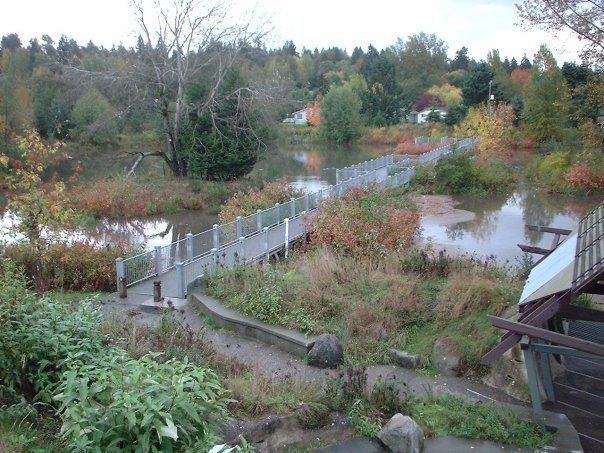
Thornton Creek in Meadowbrook
Thornton Creek, flowing through Meadowbrook, has been largely restored and daylighted, notably the confluence of the north and south forks near the Meadowbrook fields. The environmental restoration near the school and in the neighborhood is used for school class work in the sciences. The Community Center nearly faces the entry to restored Meadowbrook Pond and wetland across 35th Avenue in Matthews Beach neighborhood.