
Country United States FIPS code 54-52780 Elevation 741 m Zip code 25976 Local time Thursday 8:06 PM | Time zone Eastern (EST) (UTC-5) GNIS feature ID 1543055 Area 106 ha Population 372 (2013) Area code 304 | |
 | ||
Weather -3°C, Wind NW at 13 km/h, 41% Humidity | ||
Meadow Bridge is a town in Fayette County, West Virginia, United States. The population was 379 at the 2010 census.
Contents
Map of Meadow Bridge, WV 25976, USA
The community took its name from a nearby bridge over Meadow Creek.
Geography
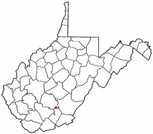
Meadow Bridge is located at 37°51′45″N 80°51′19″W (37.862399, -80.855169).
According to the United States Census Bureau, the town has a total area of 0.41 square miles (1.06 km2), all of it land.
2010 census
As of the census of 2010, there were 379 people, 165 households, and 97 families residing in the town. The population density was 924.4 inhabitants per square mile (356.9/km2). There were 186 housing units at an average density of 453.7 per square mile (175.2/km2). The racial makeup of the town was 99.2% White, 0.3% Asian, 0.3% from other races, and 0.3% from two or more races. Hispanic or Latino of any race were 0.3% of the population.
There were 165 households of which 24.2% had children under the age of 18 living with them, 41.8% were married couples living together, 12.1% had a female householder with no husband present, 4.8% had a male householder with no wife present, and 41.2% were non-families. 37.6% of all households were made up of individuals and 24.9% had someone living alone who was 65 years of age or older. The average household size was 2.30 and the average family size was 3.01.
The median age in the town was 42.5 years. 22.7% of residents were under the age of 18; 6.2% were between the ages of 18 and 24; 24.8% were from 25 to 44; 23.5% were from 45 to 64; and 22.7% were 65 years of age or older. The gender makeup of the town was 47.5% male and 52.5% female.
2000 census
As of the census of 2000, there were 321 people, 136 households, and 93 families residing in the town. The population density was 791.3 inhabitants per square mile (302.3/km²). There were 175 housing units at an average density of 431.4 per square mile (164.8/km²). The racial makeup of the town was 100.00% White.
There were 136 households out of which 29.4% had children under the age of 18 living with them, 47.1% were married couples living together, 18.4% had a female householder with no husband present, and 30.9% were non-families. 28.7% of all households were made up of individuals and 14.7% had someone living alone who was 65 years of age or older. The average household size was 2.36 and the average family size was 2.83.
In the town, the population was spread out with 22.1% under the age of 18, 11.2% from 18 to 24, 25.9% from 25 to 44, 24.0% from 45 to 64, and 16.8% who were 65 years of age or older. The median age was 39 years. For every 100 females there were 76.4 males. For every 100 females age 18 and over, there were 83.8 males.
The median income for a household in the town was $23,194, and the median income for a family was $27,000. Males had a median income of $24,444 versus $14,625 for females. The per capita income for the town was $12,526. About 15.7% of families and 24.1% of the population were below the poverty line, including 34.5% of those under age 18 and 22.0% of those age 65 or over.