
Country United States FIPS code 05-43100 Elevation 101 m Zip code 71752 Population 499 (2013) | Time zone Central (CST) (UTC-6) GNIS feature ID 0058155 Area 3.5 km² Local time Thursday 5:03 PM Area code 870 | |
 | ||
Weather 18°C, Wind S at 14 km/h, 53% Humidity | ||
McNeil is a town in Columbia County, Arkansas, United States. The population was 516 at the 2010 census, down from 662 at the 2000 census. The community was named for William B. McNeil, founder of the College Hill Academy.
Contents
Map of McNeil, AR 71752, USA
Geography
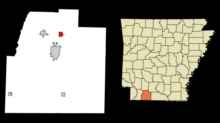
McNeil is located in northern Columbia County at 33°20′46″N 93°12′30″W (33.346030, -93.208276). It is 6 miles (10 km) north of downtown Magnolia, the county seat.
According to the United States Census Bureau, the town has a total area of 1.4 square miles (3.5 km2), all land.
Logoly State Park, part of the Arkansas State Parks System, is located just east of McNeil, off Highway 79. Most of Logoly's 368 acres (1.49 km2) comprise a State Natural Area that includes unique plant species and mineral springs.
Demographics
As of the census of 2000, there were 662 people, 237 households, and 165 families residing in the city. The population density was 493.4 people per square mile (190.7/km²). There were 280 housing units at an average density of 208.7/sq mi (80.7/km²). The racial makeup of the city was 40.33% White, 58.31% Black or African American, 0.15% Asian, and 1.21% from two or more races. 1.36% of the population were Hispanic or Latino of any race.
There were 237 households out of which 35.4% had children under the age of 18 living with them, 43.5% were married couples living together, 21.5% had a female householder with no husband present, and 30.0% were non-families. 26.2% of all households were made up of individuals and 9.7% had someone living alone who was 65 years of age or older. The average household size was 2.79 and the average family size was 3.34.
In the city, the population was spread out with 31.1% under the age of 18, 11.2% from 18 to 24, 28.7% from 25 to 44, 17.8% from 45 to 64, and 11.2% who were 65 years of age or older. The median age was 30 years. For every 100 females there were 97.6 males. For every 100 females age 18 and over, there were 90.8 males.
The median income for a household in the city was $21,136, and the median income for a family was $27,188. Males had a median income of $24,135 versus $16,563 for females. The per capita income for the city was $8,986. About 26.9% of families and 32.4% of the population were below the poverty line, including 43.2% of those under age 18 and 31.5% of those age 65 or over.
Highways
Climate
The climate in this area is characterized by hot, humid summers and generally mild to cool winters. According to the Köppen Climate Classification system, McNeil has a humid subtropical climate, abbreviated "Cfa" on climate maps.