
Population 220 (2011 census) LGA(s) Shire of Yarra Ranges Postal code 3799 | Postcode(s) 3799 | |
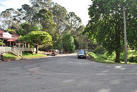 | ||
McMahons Creek is a bounded rural locality in Victoria, Australia, on the Warburton–Woods Point Road bordering the Yarra Ranges National Park. Its local government area is the Shire of Yarra Ranges. At the 2011 census, McMahons Creek had a population of 220.
Contents
Map of Mcmahons Creek VIC 3799, Australia
History
McMahons Creek Post Office opened on 1 July 1865, closed in 1870, reopened in 1901 and closed again in 1968.
References
McMahons Creek, Victoria Wikipedia(Text) CC BY-SA