
Country United States ZIP code 36783 Elevation 103 m | Time zone Central (CST) (UTC-6) Area code(s) 334 Local time Thursday 2:47 PM | |
 | ||
Weather 11°C, Wind NW at 3 km/h, 30% Humidity | ||
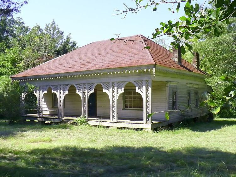
McKinley is an unincorporated community in Marengo County, Alabama, United States. McKinley had a post office at one time, but it no longer exists. Although a thriving community in its earliest years, it has since dwindled into obscurity.
Contents
Map of McKinley, AL 36783, USA
History
First known as New Ruin, the community was settled in 1815 and incorporated in 1848. The Phister Lodge #90, a masonic lodge, was granted a charter there on December 7, 1848. The name of the community was changed to McKinley in 1849 in honor of John McKinley, a U.S. Senator and Associate Justice of the United States Supreme Court.
The town grew rapidly in the 1850s and became the second largest in Marengo County, after Demopolis. Around thirty large plantations surrounded the settlement. By 1860 the community had Methodist, Baptist, and Presbyterian churches, two schools, several general stores, a brick drug store, livery stables, two-story carriage repair shop, saddle and harness shop, hotel, three shoe shops, an undertaker, tanning yard, brickyard, and grist mill.
In 1860 a fire destroyed everything on the east side of Main Street, except for the hotel. A second fire in 1869 destroyed practically the entire town. It never recovered from the combined effects of the fires, American Civil War, and a changing agricultural situation. Only the Baptist church and a few homes now remain.
Geography
McKinley is located at 32.298474°N 87.54028°W / 32.298474; -87.54028 and has an elevation of 338 feet (103 m).