
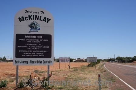
Population 417 (2011 census) Postcode(s) 4823 Postal code 4823 | Established 1888 LGA(s) McKinlay Shire Founded 1888 Local time Friday 5:33 AM | |
 | ||
Location 1,595 km (991 mi) NW of Brisbane228 km (142 mi) SE of Mount Isa108 km (67 mi) SE of Cloncurry Weather 23°C, Wind SW at 6 km/h, 46% Humidity | ||
McKinlay is a town in the remote north west of the Australian state of Queensland. The town is in the McKinlay Shire local government area and on the Landsborough Highway 1,595 kilometres (991 mi) north west of the state capital Brisbane and 228 kilometres (142 mi) south east of the regional centre of Mount Isa. At the 2011 census, McKinlay and the surrounding pastoral area had a population of 417.
Contents
Map of Mckinlay QLD 4823, Australia
History
McKinlay is named for the nearby McKinlay River—itself named for its European discoverer, the Scottish explorer John McKinlay who passed by the area in 1861. Gold was discovered in the area in 1872 and a letter receiving office was opened in 1883. The town was surveyed and allotments sold in 1888. The offices of the Shire of McKinlay were located in the town until 1930 when they were relocated to Julia Creek. Mackinlay Post Office opened on 1 April 1894 and was renamed McKinlay in 1909.
Today
McKinlay today is described as "nothing more a roadhouse, a few houses and a pub." The town is best known for the Walkabout Creek Hotel, featured in the movie Crocodile Dundee. BHP Cannington mine, Australia's largest silver and lead mine, is 85 kilometres (53 mi) west of McKinlay. The McKinlay pub has become a major tourism draw for the town and when put up for sale in 2010 attracted worldwide interest.
Facilities
McKinlay has Australia's smallest public library, park and a small museum