
Country United States County Lane ZIP code 97463 Elevation 629 m | State Oregon Time zone Pacific (PST) (UTC-8) Area code(s) 458 and 541 Local time Thursday 7:46 AM | |
 | ||
Weather 3°C, Wind NW at 5 km/h, 93% Humidity | ||
McCredie Springs is an unincorporated community in Lane County, Oregon. It is located near Oregon Route 58, about 10.7 miles (17.2 km) east of Oakridge, and 50.7 miles (81.6 km) east of Eugene. McCredie Springs is within the Willamette National Forest and is known for the nearby natural hot springs.
Contents
Map of McCredie Springs, OR, USA
McCredie Hot Springs
The hot springs are located at 43°42′14″N 122°17′14″W, on the other side of OR 58 from McCredie Springs, by the banks of Salt Creek.
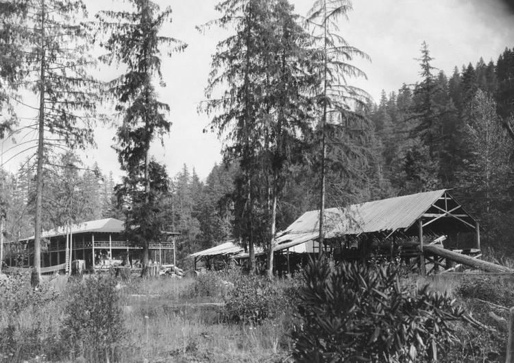
The springs were first discovered by a trapper named Frank Warner who settled near them in 1878. He lived there until the Forest Service was established in 1905 and removed him from his land. In 1911 a developer from Eugene, John Hardin, filed a mineral claim on the land. The mineral claim allowed him to lease land from the Forest Service, and he used that lease to construct a two-story resort hotel in 1914. A baseball player from Portland, William "Judge" McCredie, took over the lease in 1916 and operated the resort as a baseball camp. Although the resort changed ownership several times over the next several decades, the name "McCredie Springs" stuck. During its heyday in the 1930s, the resort was served by five Southern Pacific passenger trains each day.
The hotel burned to the ground in 1958 and a 1964 flood destroyed the bridge that provided access to the springs. The Forest Service cancelled the lease and razed the remaining buildings. Today, the site remains mostly natural.