
Country United States FIPS code 45-43630 Area 2.7 km² Zip code 29570 Local time Thursday 9:41 AM | Time zone EST (UTC-5) GNIS feature ID 1253478 Elevation 56 m Population 2,097 (2013) Area code 843 | |
 | ||
Weather 1°C, Wind NW at 11 km/h, 42% Humidity | ||
McColl is a town in Marlboro County, South Carolina, United States, located within 1.5 miles of the border with North Carolina. The population was 2,498 at the 2000 census.
Contents
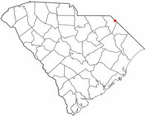
- Map of McColl SC 29570 USA
- History
- Geography
- Demographics
- 2010 Census
- Notable natives and residents
- References
Map of McColl, SC 29570, USA
Based here are two state-recognized tribes of Pee Dee people, descended from the historic people at the time of English colonization. These are the Pee Dee Tribe of South Carolina, recognized in 2006, and the Marlboro, Chesterfield, Darlington County Pee Dee Indian Tribe, recognized in 2005.
History
The town was named for D. D. McColl, a businessperson.
Geography
McColl is located at 34°40′0″N 79°32′41″W (34.666789, -79.544671).
According to the United States Census Bureau, the town has a total area of 1.1 square miles (2.8 km2), all of it land.
Demographics
As of the census of 2000, there were 2,498 people, 981 households, and 669 families residing in the town. The population density was 2,357.8 people per square mile (909.9/km²). There were 1,090 housing units at an average density of 1,028.8 per square mile (397.0/km²). The racial makeup of the town was 65.57% White, 19.22% African American, 12.69% Native American, 0.12% Asian, 0.56% from other races, and 1.84% from two or more races. Hispanic or Latino of any race were 1.48% of the population. Among the Native Americans are two tribes of Pee Dee people: the Pee Dee Tribe of South Carolina, recognized by the state in 2006, and the Marlboro, Chesterfield, Darlington County Pee Dee Indian Tribe, recognized in 2005.
There were 981 households out of which 34.5% had children under the age of 18 living with them, 41.3% were married couples living together, 21.2% had a female householder with no husband present, and 31.8% were non-families. 28.8% of all households were made up of individuals and 11.9% had someone living alone who was 65 years of age or older. The average household size was 2.55 and the average family size was 3.14.
In the town, the population was spread out with 28.2% under the age of 18, 10.3% from 18 to 24, 27.5% from 25 to 44, 22.7% from 45 to 64, and 11.3% who were 65 years of age or older. The median age was 34 years. For every 100 females there were 88.1 males. For every 100 females age 18 and over, there were 81.2 males.
The median income for a household in the town was $22,015, and the median income for a family was $27,460. Males had a median income of $26,313 versus $18,854 for females. The per capita income for the town was $10,177. About 28.5% of families and 31.6% of the population were below the poverty line, including 37.7% of those under age 18 and 31.2% of those age 65 or over.
2010 Census
According to the 2010 census, the town had a population of 2,174. Of that population, 1,235 (56.81%) were White, 493 (22.68%) were Black or African American, 364 (16.74%) were American Indian or Alaska Native, 65 (2.99%) were two or more races, 14 (0.64%) were some other race. There were 42 (1.93%) were Hispanic or Latino.