
Country Russia Administrative center of Maysky District | Administrative district Maysky District Local time Thursday 7:00 AM | |
 | ||
Federal subject Kabardino-Balkar Republic Municipal district Maysky Municipal District Urban settlement Maysky Urban Settlement Weather 6°C, Wind W at 6 km/h, 79% Humidity | ||
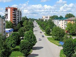
Maysky (Russian: Ма́йский) is a town and the administrative center of Maysky District of the Kabardino-Balkar Republic, Russia, located 40 kilometers (25 mi) northeast of Nalchik, the capital of the republic. Population: 26,755 (2010 Census).
Contents
- Map of Maysky Kabardino Balkaria Russia
- History
- Administrative and municipal status
- Demographics
- Ethnic composition
- References
Map of Maysky, Kabardino-Balkaria, Russia
History
A Russian military outpost of Prishib was founded in 1819. It was re-organized as the stanitsa of Prishibskaya in 1829. In 1875, Kotlyarevskaya railway station was built 3 kilometers (1.9 mi) south of the stanitsa and a settlement formed around it in 1888. In 1920, that settlement was renamed Prishibsky, in 1925—Maysky. In 1959, the settlement and the stanitsa were merged into the urban-type settlement of Maysky, which was granted town status in 1965.
Administrative and municipal status
Within the framework of administrative divisions, Maysky serves as the administrative center of Maysky District, to which it is directly subordinated. As a municipal division, the town of Maysky, together with five rural localities, is incorporated within Maysky Municipal District as Maysky Urban Settlement.
Demographics
Population: 26,755 (2010 Census); 27,037 (2002 Census); 24,533 (1989 Census).
Ethnic composition
As of the 2002 Census, the ethnic distribution of the population was: