
Country Philippines Barangays ZIP code 3602 Local time Thursday 11:49 AM | District Lone District Time zone PST (UTC+8) Area 238 km² Province Ifugao | |
 | ||
Region Cordillera Administrative Region (CAR) Weather 22°C, Wind E at 3 km/h, 85% Humidity | ||
Mayoyao is a fourth class municipality in the province of Ifugao, Philippines. According to the 2015 census, it has a population of 17,331 people.
Contents
- Map of Mayoyao Ifugao Philippines
- Barangays
- Battle of Mayoyao Ridge
- Historical marker
- Demographics
- References
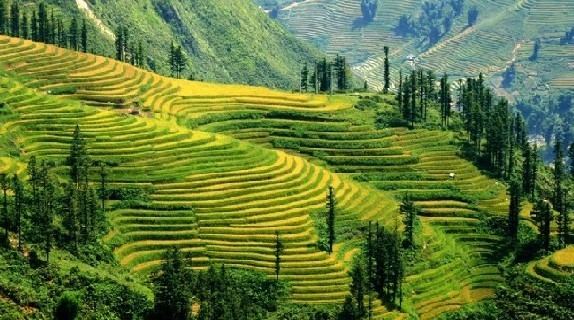
Map of Mayoyao, Ifugao, Philippines
Barangays
Mayoyao is politically subdivided into 27 barangays.
Battle of Mayoyao Ridge
From July 26, to August 9, 1945, Filipino soldiers under the command of Donald Blackburn, supported by airstrikes by Army Air Forces, captured the Japanese stronghold of Mayoyao, Ifugao in Northern Luzon. This included the Filipino troops of the 1st, 2nd, 11th, 12th, 13th, 15th and 16th Infantry Division of the Philippine Commonwealth Army, 1st Infantry Regiment of the Philippine Constabulary, 11th and 14th Infantry Regiment of the United States Armed Forces in the Philippines - Northern Luzon or USAFIP-NL and the American bomber pilots of the United States Army Air Forces was fought against the Japanese Imperial forces during the Battle of Mayoyao Ridge until the end of World War II.
Historical marker
The memorial or historical marker, located at Mount Nagchajan in Mayoyao, Ifugao, marks the site of the “Battle of Mayoyao Ridge”. The battle was fought between the Japanese Imperial forces and the combined Filipino and American soldiers, towards the end of World War II. The result was key to the eventual surrender of General Yamashita at Kiangan, Ifugao.
Demographics
In the 2015 census, the population of Mayoyao was 17,331 people, with a density of 73 inhabitants per square kilometre or 190 inhabitants per square mile.