
District Jbeil Lowest elevation 800 m (2,600 ft) Area 8.11 km² Area code +961 | Highest elevation 1,100 m (3,600 ft) Time zone EET (UTC+2) Local time Thursday 3:50 AM | |
 | ||
Weather 5°C, Wind S at 6 km/h, 74% Humidity | ||
Mayfouq (Arabic: ميفوق, also known as Qottara) is a village and municipality in the Jbeil District of Mount Lebanon Governorate, Lebanon. It is located 64 km north of Beirut. Mayfouq has an average elevation of 860 meters above sea level and its total land area is 811 hectares. Its inhabitants are predominantly Maronite Catholics.
Map of Mayfouq, Lebanon
Mayfouq has a municipality as of 1998 and the current president is Youssef Adib Wehbe. Educational institutions in Mayfouq include the Convent primary school and a secondary school.
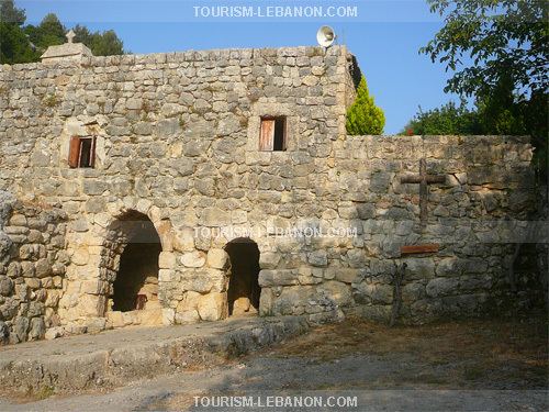
Mayfouq was the second Maronite Patriarchal location in Lebanon. There are a number of churches in the village, including Our Lady of Ilige, Our Lady of Mayfouq, Mart Moura, Al Sayde Kfarchelli, and many other deserted churches such Mar Saba, St Georges (Mar Girgis). Convents include Our Lady of Mayfouq Convent and Mar Challita Convent (Kattara), which are under the patronage of the Lebanese Maronite Order.
The village is also home to the Achtarout Club (Arabic: نادي عشتروت الرياضي), which was founded by Joseph Noon, Mayfouq's team won several trophies and was champion of the Jbeil clubs tournament in volleyball for four years.