
Area 47.07 km² Local time Wednesday 6:00 PM | Phone number 0261-62-3111 Population 9,800 (Oct 2016) | |
 | ||
Weather 2°C, Wind NW at 11 km/h, 82% Humidity Points of interest Chihiro Art Museum Azumino, Amabikiyama, Mt. Obora | ||
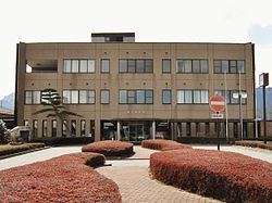
Matsukawa (松川村, Matsukawa-mura) is a village located in Kitaazumi District in northeast Nagano Prefecture, in the Chūbu region of Japan. As of 1 October 2016, the village had an estimated population of 9,800 and a population density of 208 persons per km². Its total area was 47.07 square kilometres (18.17 sq mi).
Contents
- Map of Matsukawa Kitaazumi District Nagano Prefecture Japan
- Geography
- Surrounding municipalities
- History
- Education
- Railway
- Highway
- International relations
- References
Map of Matsukawa, Kitaazumi District, Nagano Prefecture, Japan
Geography
Matsukawa is located in northwestern Nagano Prefecture, in the Azumidaira plateau, bordered by the Hida Mountains to the north and west.
Surrounding municipalities
History
The area of present-day Matsukawa was part of ancient Shinano Province and was part of the territory controlled by Matsumoto Domain under the Tokugawa shogunate of the Edo period. The modern village of Matsukawa was established on April 1, 1889 by the establishment of the municipalities system.
Education
Matsukawa has one public elementary school and one public middle school operated by the village government. The village does not have a high school.