
FIPS code 19-50385 Elevation 427 m Population 88 (2013) Local time Wednesday 2:30 AM | Time zone Central (CST) (UTC-6) GNIS feature ID 0458854 Area 96 ha Zip code 51244 Area code 712 | |
 | ||
Weather -16°C, Wind SE at 13 km/h, 100% Humidity | ||
Matlock is a city in Sioux County, Iowa, United States. The population was 87 at the 2010 census.
Contents
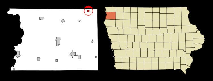
Map of Matlock, IA 51244, USA
Geography
Matlock is located at 43°14′35″N 95°56′4″W (43.242958, -95.934486).
According to the United States Census Bureau, the city has a total area of 0.37 square miles (0.96 km2), all of it land.
2010 census
As of the census of 2010, there were 87 people, 34 households, and 24 families residing in the city. The population density was 235.1 inhabitants per square mile (90.8/km2). There were 35 housing units at an average density of 94.6 per square mile (36.5/km2). The racial makeup of the city was 100.0% White.
There were 34 households of which 29.4% had children under the age of 18 living with them, 64.7% were married couples living together, 2.9% had a female householder with no husband present, 2.9% had a male householder with no wife present, and 29.4% were non-families. 17.6% of all households were made up of individuals and 8.8% had someone living alone who was 65 years of age or older. The average household size was 2.56 and the average family size was 2.96.
The median age in the city was 44.2 years. 25.3% of residents were under the age of 18; 6.8% were between the ages of 18 and 24; 20.7% were from 25 to 44; 29.8% were from 45 to 64; and 17.2% were 65 years of age or older. The gender makeup of the city was 55.2% male and 44.8% female.
2000 census
As of the census of 2000, there were 83 people, 33 households, and 26 families residing in the city. The population density was 219.6 people per square mile (84.3/km²). There were 35 housing units at an average density of 92.6 per square mile (35.6/km²). The racial makeup of the city was 97.59% White and 2.41% Native American.
There were 33 households out of which 36.4% had children under the age of 18 living with them, 78.8% were married couples living together, and 21.2% were non-families. 18.2% of all households were made up of individuals and 3.0% had someone living alone who was 65 years of age or older. The average household size was 2.52 and the average family size was 2.88.
In the city, the population was spread out with 25.3% under the age of 18, 7.2% from 18 to 24, 38.6% from 25 to 44, 18.1% from 45 to 64, and 10.8% who were 65 years of age or older. The median age was 37 years. For every 100 females there were 107.5 males. For every 100 females age 18 and over, there were 121.4 males.
The median income for a household in the city was $36,750, and the median income for a family was $41,875. Males had a median income of $23,750 versus $16,875 for females. The per capita income for the city was $17,448. There were 4.0% of families and 11.1% of the population living below the poverty line, including 17.4% of under eighteens and none of those over 64.