
Local time Wednesday 3:35 AM | Council Mateh Yehuda Founded 1950 Population (2015) 897 | |
 | ||
Weather 5°C, Wind E at 3 km/h, 99% Humidity | ||
Mata (Hebrew: מַטָּע, lit. Grove) is a moshav in central Israel. Located in the Jerusalem corridor near Beit Shemesh, it falls under the jurisdiction of Mateh Yehuda Regional Council. In 2015 it had a population of 897.
Contents
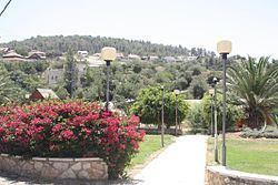
Map of Mata, Israel
Etymology
"The name mata is also hinted at in Ezekiel (XXXIV, 29)": I will provide for them a grove.
History
The village was established in 1950 by immigrants from Yemen on land which had formerly belonged to the depopulated Arab village of Allar. After two Yemenite Jews were murdered by local Arabs, the Yemenite community eventually moved to more populated areas of Petah Tikva and Karkur. The founders were later joined by more immigrants from Morocco. Tobacco was once grown there by the early residents, but this has been replaced by grape vineyards.
Archaeology
Along the old Roman Road (now regional highway 375) are the ruins of a travelers' inn and livery stable, now called "khanut" (formerly, Khirbet el-Khan). It was described by Edward Robinson in 1838, in his Biblical Researches in Palestine. A mosaic floor with Greek writing of a Byzantine type can still be seen in the remains of the structure, believed to have been used as a church.
In the 12th century, a rural monastery was established there by the Crusaders consisting of several barrel-vaulted buildings, an enclosure wall and a chapel. British archaeologist Denys Pringle proposed that the complex was a Cistercian house called "Saluatio" established in 1169.
In the valley are various types of trees: Sweet and bitter almonds, olives, grapes, pomegranates, lemons, figs, walnuts, Syrian pears, carobs and hawthorns. To the south-east of the moshav is a natural spring called `Ain Jerash named after a nearby small Arab village (now abandoned) and which was built on a spur near the town of Tzur Hadassah (Har Kitron). Rock-carved niches used as tombs can still be seen in the abandoned village.
Landmarks
To the east of the moshav is Wadi Tannur, a riverine gulch with two natural springs - Ein Mata (Spring of the Orchard) and Ein Tanur.
At the foot of Ein Tannur ("Oven Spring") is an ancient tunnel dug deeply to catch the water at the source and increase its flow - a spring-flow tunnel. According to a local legend, Noah's oven was located here before the flood. When God destroyed the world, Noah's oven began spouting water, proving Noah's great commitment to God. When the flood was over and the water subsided, the oven forgot its original purpose and water continued to flow from it. When Noah passed by in his ark, he only saw the spring rather than his oven, so he continued his journey and finally landed on Mount Ararat.