
Architectural style Burr Arch design Opened 1854 | Built 1854 (1854) NRHP Reference # 74000771 Area 2,000 m² Added to NRHP 31 December 1974 | |
 | ||
Address Little Marys River,, Chester, IL 62233, United States Similar Piney Creek Ravine St, Fort Kaskaskia State Hist, Pierre Menard House, Sugar Creek Covered, Chester Bridge | ||
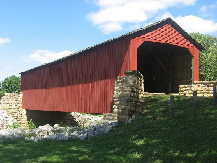
Mary s river covered bridge chester illinois
Mary's River Covered Bridge is a covered bridge which crosses Marys River 4 miles (6.4 km) northeast of Chester, Illinois. The Burr truss bridge is 86 feet (26 m) long and 17 feet 8 inches (5.38 m) wide. The bridge was built in 1854 as part of a plank toll road connecting Chester to Bremen; the bridge allowed agricultural products to be transported to Chester, a significant port on the Mississippi River. In the early 1870s, the toll road and the bridge were sold to Randolph County. The bridge served road traffic until 1930.
In 1936, the State of Illinois assumed ownership of the bridge in order to preserve it. The bridge is now located in a picnic area and park on the south side of Illinois Route 150. It is the only extant covered bridge in Southern Illinois.
The bridge was added to the National Register of Historic Places on December 31, 1974.