
- land 12.5 sq mi (32 km) Local time Monday 7:48 AM University Eastern Bible Institute | - summer (DST) EDT (UTC-4) Population 3,104 (2000) | |
 | ||
- water 0.2 sq mi (1 km), 1.57% Weather -11°C, Wind S at 0 km/h, 73% Humidity | ||
Marlborough Township is a township in Montgomery County, Pennsylvania, United States. The population was 3,178 at the 2010 census.
Contents
- Map of Marlborough Township PA USA
- History
- Geography
- Adjacent municipalities
- Demographics
- Government and politics
- References
Map of Marlborough Township, PA, USA
It is part of the Upper Perkiomen School District.
History
The Bauern Freund Print Shop, Andreas Rieth Homestead, Sutch Road Bridge in Marlborough Township, and Swamp Creek Road Bridge are listed on the National Register of Historic Places.
Geography
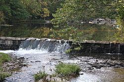
According to the United States Census Bureau, the township has a total area of 12.7 square miles (32.9 km2), of which, 12.5 square miles (32.5 km2) of it is land and 0.2 square miles (0.4 km2) of it (1.34%) is water. It is drained by the Perkiomen Creek into the Schuylkill River and consists mainly of rolling hills and valleys. Its villages include Hoppenville, Perkiomenville (also in Upper Frederick,) and Sumneytown. Its numbered routes are 29 and 63, which has its NW terminus on north-to-south 29 in Green Lane. Other local roads of note include Finland Road, Geryville Pike, Hoppenville Road, Knight Road, Swamp Creek Road, and Upper Ridge Road.
Adjacent municipalities
Demographics
As of the 2010 census, the township was 97.4% White, 1.0% Black or African American, 0.2% Native American, 0.2% Asian, and 1.0% were two or more races. 1.2% of the population were of Hispanic or Latino ancestry.
As of the census of 2000, there were 3,104 people, 1,174 households, and 888 families residing in the township. The population density was 247.6 people per square mile (95.6/km2). There were 1,222 housing units at an average density of 97.5/sq mi (37.7/km2). The racial makeup of the township was 97.55% White, 0.71% African American, 0.13% Native American, 0.16% Asian, 0.64% from other races, and 0.81% from two or more races. Hispanic or Latino of any race were 1.10% of the population.
There were 1,174 households, out of which 32.5% had children under the age of 18 living with them, 67.0% were married couples living together, 6.1% had a female householder with no husband present, and 24.3% were non-families. 19.8% of all households were made up of individuals, and 6.9% had someone living alone who was 65 years of age or older. The average household size was 2.63 and the average family size was 3.06.
In the township the population was spread out, with 23.6% under the age of 18, 6.6% from 18 to 24, 28.1% from 25 to 44, 28.9% from 45 to 64, and 12.8% who were 65 years of age or older. The median age was 40 years. For every 100 females there were 99.0 males. For every 100 females age 18 and over, there were 98.3 males.
The median income for a household in the township was $60,170, and the median income for a family was $68,750. Males had a median income of $47,188 versus $31,667 for females. The per capita income for the township was $26,273. About 0.8% of families and 2.3% of the population were below the poverty line, including 0.7% of those under age 18 and 5.3% of those age 65 or over.
Government and politics
Marlborough Township has a Township Manager and a 3-person Board of Supervisors.