
Country United States County Forest Time zone Eastern (EST) (UTC-5) Elevation 529 m Population 3,137 (2010) | State Pennsylvania ZIP code 16239 Area 15.7 km² | |
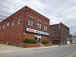 | ||
Marienville is an unincorporated community and census-designated place (CDP) in Jenks Township, Forest County, Pennsylvania, United States. Its altitude is 1,735 feet (529 m), and it is located at 41°28′12″N 79°7′29″W (41.4702014, -79.1247623). Other names for the community have included "Marion", "Marion Centre", and "Marionville". Marienville is a major point on a well-known ATV trail. According to the 2010 census the population of Marienville was 3,137.
Contents
Map of Marienville, PA 16239, USA
Marienville is the location of the SCI Forest state penitentiary.
Geography
The community is in southeastern Forest County near the center of Jenks Township. Pennsylvania Route 66 is the main street, leading northeast 24 miles (39 km) to U.S. Route 6 at Kane and southwest 27 miles (43 km) to Interstate 80 near Clarion. Pennsylvania Route 899 leads south from Marienville 10 miles (16 km) to Clarington.
According to the U.S. Census Bureau, the Marienville CDP has a total area of 6.1 square miles (15.7 km2), all land.