
Quadrant NW Sector Southeast Area 69 ha Population 1,711 (2012) | Ward 11 Elevation 704 m | |
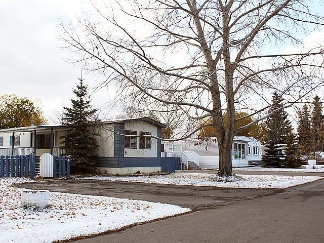 | ||
Maple Ridge, or Maple Ridge/Oak Ridge, is a neighbourhood in southeast Edmonton, Alberta, Canada. A manufactured home community, it is located on the east side of 17 Street NW at 66 Avenue NW. It is surrounded by industrial lands.
Contents
Map of Maple Ridge, Edmonton, AB, Canada
Maple Ridge had a population of 1,711 according to Edmonton's 2012 municipal census.
Three out of four of the homes in Maple Ridge (75.2%) were moved into the community during the 1970s, with a small percentage (3.5%) predating 1970. Most of the remainder were moved into Maple Ridge during the first half of the 1980s.
All the homes in the neighbourhood are manufactured homes. Owner-occupancy is high, with roughly 96% of homes being owner occupied.
Demographics
In the City of Edmonton's 2012 municipal census, Maple Ridge had a population of 7003171100000000000♠1,711 living in 7002863000000000000♠863 dwellings, a -4.1% change from its 2009 population of 7003178400000000000♠1,784. With a land area of 0.69 km2 (0.27 sq mi), it had a population density of 7003247970000099999♠2,479.7 people/km2 in 2012.