
Population 35,817 (2011) | Area 27.85 km² Local time Monday 1:34 PM | |
 | ||
Time zone Sri Lanka Standard Time Zone (UTC+5:30) Weather 32°C, Wind SW at 19 km/h, 69% Humidity Neighborhoods Emil Nager, Kullanthai Easu Puram, Peryakamam, Mannar Turkish Village, Selvanagar | ||
Road to mannar sri lanka wilpattu national park
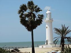
Mannar (Tamil: மன்னார், Sinhalese: මන්නාරම), formerly spelled Manar, is a large town and the main town of Mannar District, Northern Province, Sri Lanka. It is governed by an Urban Council. The town is located on Mannar Island overlooking the Gulf of Mannar and is home to the historic Ketheeswaram temple.
Contents
Map of Mannar, Sri Lanka
Mannar is known for its baobab trees and for its fort, built by the Portuguese in 1560 and taken by the Dutch in 1658 and rebuilt; its ramparts and bastions are intact, though the interior is largely destroyed. Formerly the town was renowned as a center of pearl fishing, mentioned in the 2nd-century CE Periplus of the Erythraean Sea. Visually, the modern town is dominated by its Hindu temples, mosques and churches. The Catholic Church has a diocese headquartered in the town. By rail the town is connected to the rest of Sri Lanka by the Mannar Line. It was occupied by LTTE during Sri Lankan Civil War between 1983 and 2009.