
Country Philippines Barangays Area 130.5 km² Province Benguet | Founded 1955 Time zone PST (UTC+8) Local time Monday 3:14 PM | |
 | ||
Region Cordillera Administrative Region (CAR) District Lone district of Benguet Weather 24°C, Wind W at 6 km/h, 65% Humidity | ||
Mankayan, officially the Municipality of Mankayan (Ilocano: Ili ti Mankayan; Filipino: Bayan ng Mankayan), is a municipality in the province of Benguet in the Cordillera Administrative Region (CAR) of the Philippines. The population was 35,953 at the 2015 census. In the 2016 electoral roll, it had 18,801 registered voters.
Contents
- Map of Mankayan Benguet Philippines
- Etymology
- Pre colonial period
- Spanish period
- American period
- Second World War
- Post war era
- Geography
- Barangays
- Demographics
- Public schools
- References
Map of Mankayan, Benguet, Philippines
The municipality is known as a mining town, being the location of several mines, including the Lepanto Consolidated Mining Company.
Etymology
The name "Mankayan" is derived from Nancayan, the Hispanic term of the native name of the place, Nangkayang (which means "high up in the mountain").
Pre-colonial period
Nangkayang was once a heavily-forested area. The natives of the surrounding settlements of Panat and Bag-ongan mined gold through the labon system, after its reported discovery in a river. Copper was later discovered by the end of the 16th century in Kamangga-an (location of present-day Lepanto).
Spanish period
By the 1800s, the Spanish colonial government sent expeditions to survey the mines. On February 3, 1850, an expedition led by engineer Don Antonio Hernandez confirmed the presence of copper in Mankayan.
In 1852, Lepanto was established by the Spanish as a comandancia politico-militar, composed of several rancherias which included Mankayan.
A mining company was established by Señor Tomas Balbas y Castro in 1856, called the Sociedad Minero-Metalurgica Cantabro Filipino de Mancayan. The company ceased operations in 1875.
American period
Under the American rule, Mankayan remained under the jurisdiction of Lepanto, and later Lepanto-Bontoc until the latter's dissolution. Mankayan was later annexed to the sub-province of Benguet as a municipal district in 1913.
The mining boom in Mankayan began in 1933, with American Victor Lednickey establishing the Lepanto Consolidated Mining Company on September 26, 1936.
Second World War
In 1942, following the outbreak of the war, the Lepanto Consolidated Mining Company, together with the Suyoc Consolidated Mining Company, were taken over by the Japanese Mitsui Mining Company, which renamed the mines into "Mitsui Mankayan Copper Mines". The Mitsui Company controlled the mines until 1945.
Post-war era
After the war, the Lepanto Consolidated Mining Company resumed the mining operations.
Mankayan was converted from a municipal district into a regular municipality on June 16, 1955, by virtue of Republic Act 1302.
Geography
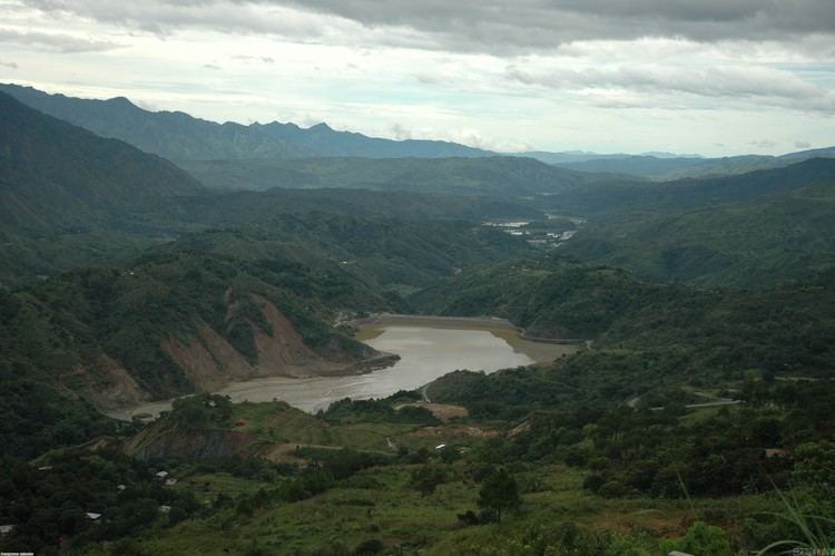
Mankayan is located at 16°52′N 120°47′E, on the north-western tip of Benguet. It is bordered by Bakun on the west, Buguias on the southeast, Tadian and Bauko on the east, and Cervantes on the north-west.
According to the Philippine Statistics Authority, the municipality has a land area of 130.48 square kilometres (50.38 sq mi) constituting 7000471000000000000♠4.71% of the 2,769.08-square-kilometre- (1,069.15 sq mi) total area of Benguet.
Barangays
Mankayan is politically subdivided into 12 barangays.
Demographics
In the 2015 census, Mankayan had a population of 35,953. The population density was 280 inhabitants per square kilometre (730/sq mi).
In the 2016 electoral roll, it had 18,801 registered voters.
Public schools
As of 2014, Mankayan has 35 public elementary schools and 9 public secondary schools.