
Existed: 1947 – present Constructed 1947 | Length 732 km | |
 | ||
Towns Grosse Isle, Manitoba, Warren, Manitoba, Lundar, Manitoba, Eriksdale, Manitoba, Ashern, Manitoba, Grand Rapids | ||
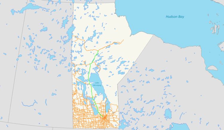
Provincial Highway 6 (PTH 6) is a provincial highway in the Canadian province of Manitoba. It runs from the Perimeter Highway of Winnipeg to the Thompson south city limits. It is also the main highway connecting Winnipeg to northern Manitoba. The speed limit is 100 km/h. The route is also used to deliver nickel from the Thompson mine to the Royal Canadian Mint in Winnipeg. The portion of the highway between Ponton and Thompson was previously known as Highway 391.
Map of MB-6, Manitoba, Canada
There have been talks of extending PTH 6 North to Churchill and the Nunavut border. If plans to make a highway in Nunavut connecting from Churchill, and Arviat, Nunavut to Chesterfield Inlet, Nunavut go through, then the first ever major road connection to Nunavut will be made.
References
Manitoba Highway 6 Wikipedia(Text) CC BY-SA