
Country United States Time zone Central (CST) (UTC-6) Elevation 502 m Population 19,887 (2013) | Founded 1881 Area code(s) 701 Zip code 58554 Local time Sunday 5:01 PM | |
 | ||
Weather 11°C, Wind NW at 18 km/h, 49% Humidity | ||
National guard checkpoint on hwy 1806 south of mandan north dakota
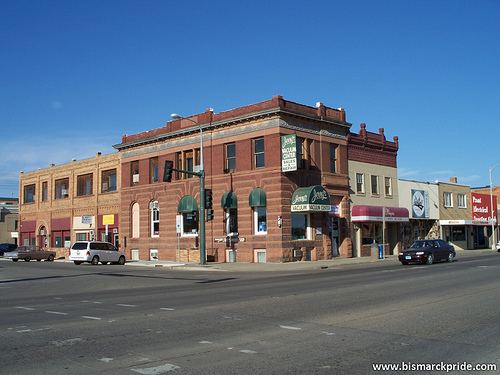
Mandan is a city in Morton County and the eighth-largest city in North Dakota. Founded in 1879 on the west side of the upper Missouri River, it became the county seat of Morton County in 1881. The U.S. Census Bureau measured the population at 18,331 in the 2010 census and estimated the 2015 population at 21,382. Located across the Missouri River from the state capital of Bismarck, Mandan is a core city of the Bismarck-Mandan Metropolitan Statistical Area.
Contents
- National guard checkpoint on hwy 1806 south of mandan north dakota
- Map of Mandan ND 58554 USA
- Geography
- Climate
- 2010 census
- 2000 census
- Industry
- Education
- Hospitals
- Local media
- Notable people
- References
Map of Mandan, ND 58554, USA
The city was named after the historic Mandan Indians of the area. In 2013, Mandan was selected a finalist in Rand McNally Most Patriotic City competition.
Geography
According to the United States Census Bureau, the city has a total area of 11.13 square miles (28.83 km2), of which 11.03 square miles (28.57 km2) is land and 0.10 square miles (0.26 km2) is water.
Climate
This climatic region is typified by large seasonal temperature differences, with warm to hot (and often humid) summers and cold (sometimes severely cold) winters. According to the Köppen Climate Classification system, Mandan has a humid continental climate, abbreviated "Dfb" on climate maps.
2010 census
As of the census of 2010, there were 18,331 people, 7,632 households, and 4,921 families residing in the city. The population density was 1,661.9 inhabitants per square mile (641.7/km2). There were 7,950 housing units at an average density of 720.8 per square mile (278.3/km2). The racial makeup of the city was 91.7% White, 0.6% African American, 4.9% Native American, 0.2% Asian, 0.1% Pacific Islander, 0.5% from other races, and 2.0% from two or more races. Hispanic or Latino of any race were 1.8% of the population.
There were 7,632 households of which 31.6% had children under the age of 18 living with them, 48.4% were married couples living together, 11.5% had a female householder with no husband present, 4.6% had a male householder with no wife present, and 35.5% were non-families. 28.9% of all households were made up of individuals and 10.5% had someone living alone who was 65 years of age or older. The average household size was 2.35 and the average family size was 2.89.
The median age in the city was 37.2 years. 23.9% of residents were under the age of 18; 8.2% were between the ages of 18 and 24; 27.3% were from 25 to 44; 27.2% were from 45 to 64; and 13.2% were 65 years of age or older. The gender makeup of the city was 49.2% male and 50.8% female.
2000 census
As of the census of 2000, there were 16,718 people, 6,647 households, and 4,553 families residing in the city. The population density was 1,642.8 per square mile (634.3/km2). There were 6,958 housing units at an average density of 683.7 per square mile (264.0/km2). The racial makeup of the city was 94.98% White, 0.20% African American, 3.02% Native American, 0.33% Asian, 0.01% Pacific Islander, 0.15% from other races, and 1.30% from two or more races. Hispanic or Latino of any race were 0.78% of the population.
The top 6 ancestry groups in the city were German (61.3%), Norwegian (15.4%), Russian (13.1%), Irish (7.9%), English (4.2%), and Native American (3.02%).
There were 6,647 households out of which 35.7% had children under the age of 18 living with them, 54.1% were married couples living together, 10.6% had a female householder with no husband present, and 31.5% were non-families. 26.4% of all households were made up of individuals and 10.1% had someone living alone who was 65 years of age or older. The average household size was 2.48 and the average family size was 3.01.
In the city, the population was spread out with 27.0% under the age of 18, 9.0% from 18 to 24, 29.7% from 25 to 44, 21.6% from 45 to 64, and 12.7% who were 65 years of age or older. The median age was 36 years. For every 100 females there were 97.0 males. For every 100 females age 18 and over, there were 93.6 males.
The median income for a household in the city was $38,182, and the median income for a family was $46,210. Males had a median income of $31,653 versus $21,400 for females. The per capita income for the city was $17,509. About 7.0% of families and 10.0% of the population were below the poverty line, including 12.2% of those under age 18 and 13.6% of those age 65 or over.
Industry
A Tesoro refinery north of Mandan began operations in 1954 and today has a capacity of 71,000 barrels per day (bpd). It processes primarily North Dakota sweet (low-sulfur) crude oil into gasoline, diesel fuel, jet fuel, heavy fuel oils and liquefied petroleum gas.
Education
Mandan Public Schools operates Roosevelt Elementary School, Mary Stark Elementary School, Lewis & Clark Elementary School, Ft. Lincoln Elementary School, Custer Elementary School, Red Trail Elementary School, Mandan Middle School, and Mandan High School, as well as the Brave Center Academy night school. There are two private schools: Christ the King School and St. Joseph School.
Bismarck State College offers a Mechanical Maintenance Technology program at its Mandan campus.
Hospitals
Triumph Hospital Central Dakotas is a 41-bed critical care hospital in Mandan.
Local media
Mandan shares a print, radio, and television media market with nearby Bismarck.