
District Manang District Elevation 3,519 m Local time Monday 12:49 AM | Admin. division Gandaki Zone Time zone Nepal Time (UTC+05:45) Population 6,527 (2001) Number of airports 1 | |
 | ||
Manang (Nepali: मनाङ) is a town in the Manang District of Nepal. It is located at 28°40'0N 84°1'0E with an altitude of 3,519 metres (11,545 ft). According to the preliminary result of the 2011 Nepal census it has a population of 6,527 people living in 1,495 individual households. Its population density is 3 persons/km2.
Map of Manang 33500, Nepal
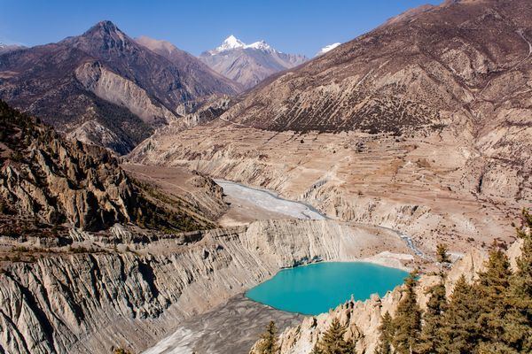
It is situated in the broad valley of the Marshyangdi River to the north of the Annapurna mountain range. The river flows to the east. To the west, the 5,416-metre (17,769 ft) Thorong La pass leads to Muktinath shrine and the valley of the Gandaki River. To the north there is the Chulu East peak of 6,584 m (21,601 ft). Most groups trekking around the Annapurna range will take resting days in Manang to acclimatize to the high altitude, before taking on Thorong La pass. The village is situated on the northern slope, which gets the most sunlight and the least snow cover in the winter. The cultivation fields are on the north slope with terraces.
There are now motorable road as well as trails where goods are transported on jeep or mule trains or carried by porters. A small airport, located 2.5 km (1.6 mi) east of the town, serves the whole valley. The airport was begun in 1985. The development of a trail linking Manang to the Annapurna Conservation Area was finished in February 2011 and has brought many benefits to the villagers and the area.
Besides catering to trekkers, there is some agriculture and herding of yaks. There is a medical centre, which specializes in high-altitude sickness.