
OS grid reference SO689714 Sovereign state United Kingdom Local time Sunday 2:41 PM | Civil parish Mamble Post town KIDDERMINSTER | |
 | ||
Weather 12°C, Wind SW at 23 km/h, 84% Humidity | ||
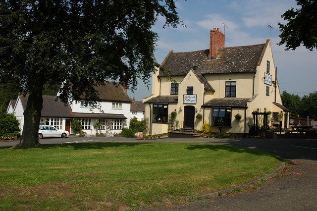
Mamble is a village and civil parish in the Malvern Hills District in the county of Worcestershire, England. It is located on the A456 between Bewdley and Tenbury Wells. Notable buildings include the 13th century sandstone church of St John the Baptist and the 17th century Sun & Slipper Inn. Its craft centre was closed in summer 2006.
Map of Mamble, Kidderminster, UK
Roman remains have been found in the area, and at the time of the Domesday Book the settlement was known as Mamele. Although agriculture was always a major industry for the inhabitants of Mamble, coal mining was also important from the 14th century onwards, and the last local pit, at Hunthouse to the south-east of the village, remained in operation until its closure in 1972. In the 1790s the Leominster Canal was opened in the area which allowed coal to be carried to Tenbury Wells and Herefordshire, but the canal was unprofitable and was closed in 1859.
Mamble was in the lower division of Doddingtree Hundred.
The poet John Drinkwater wrote a poem about the village, called simply Mamble: