
Country United States FIPS code 36-033-44721 Elevation 241 m Population 14,545 (2010) Area code 518 | State New York Time zone Eastern (EST) (UTC-5) GNIS feature ID 979185 Zip code 12953 Local time Sunday 6:29 AM | |
 | ||
Weather -9°C, Wind S at 5 km/h, 66% Humidity Area 266.3 km² (262.9 km² Land / 3.367 km² Water) | ||
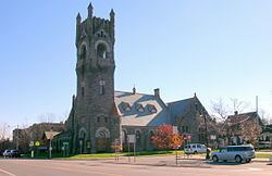
Old north country community college in malone new york
Malone is a town in Franklin County, New York, United States. The population was 14,545 at the 2010 census. The town contains a village also named Malone, which is the county seat. The town is an interior town, located in the north-central part of the county.
Contents
- Old north country community college in malone new york
- Map of Malone NY 12953 USA
- Fun time in malone new york
- History
- Notable natives
- Geography
- Demographics
- Communities and locations in the Town of Malone
- Notable residents
- References
Map of Malone, NY 12953, USA
Fun time in malone new york
History
The town was formed from part of the town of Chateaugay in 1805. The town was originally named "Harison", after Richard Harison who had purchased the land and founded the town. The name was changed in 1808 to "Ezraville", after Ezra L'Hommedieu, and in 1812 to "Malone".
During the War of 1812 the village was sacked by British troops making incursions from what would become Canada.
Former Governor Mario Cuomo instituted financial measures to increase economic stability to the county by bringing in many prisons (state and federal) to help "strengthen" the area.
Notable natives
Notable natives include:
Geography
According to the United States Census Bureau, the town has a total area of 102.8 square miles (266.3 km2), of which 101.5 square miles (262.9 km2) is land and 1.3 square miles (3.3 km2), or 1.25%, is water.
U.S. Route 11 and New York State Route 11B are east-west highways across the town, and New York State Route 30 and New York State Route 37 are north-south highways.
The Salmon River flows northward through the center of town, and the Trout River flows across the northeast corner.
Demographics
As of the census of 2000, there were 14,981 people, 4,114 households, and 2,620 families residing in the town. The population density was 147.1 people per square mile (56.8/km²). There were 4,644 housing units at an average density of 45.6 per square mile (17.6/km²). The ethnic makeup of the town was 73.61% White, 18.56% Black or African American, 0.49% Native American, 0.63% Asian, 6.25% from other races, and 0.45% from two or more races. Hispanic or Latino of any race were 11.19% of the population.
There were 4,114 households out of which 30.2% had children under the age of 18 living with them, 46.5% were married couples living together, 12.7% had a female householder with no husband present, and 36.3% were non-families. 30.7% of all households were made up of individuals and 14.3% had someone living alone who was 65 years of age or older. The average household size was 2.36 and the average family size was 2.91.
In the town, the population was spread out with 16.3% under the age of 18, 10.4% from 18 to 24, 42.1% from 25 to 44, 19.2% from 45 to 64, and 12.1% who were 65 years of age or older. The median age was 36 years. For every 100 females there were 179.4 males. For every 100 females age 18 and over, there were 201.5 males.
The median income for a household in the town was $27,716, and the median income for a family was $37,500. Males had a median income of $25,996 versus $20,506 for females. The per capita income for the town was $17,352. About 8.1% of families and 12.7% of the population were below the poverty line, including 14.8% of those under age 18 and 11.5% of those age 65 or over.