
Country Czech Republic District Blansko Elevation 387 m Population 136 (2006) | Region South Moravian Postal code 679 21 Area 2.63 km² | |
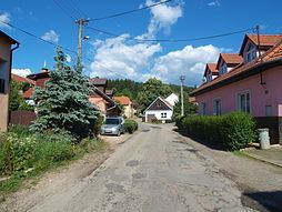 | ||
Malá Lhota is a village and municipality (obec) in Blansko District in the South Moravian Region of the Czech Republic.
Map of Mal%C3%A1 Lhota, Czechia
The municipality covers an area of 2.63 square kilometres (1.02 sq mi), and has a population of 136 (as at 3 July 2006).
Malá Lhota lies approximately 8 kilometres (5 mi) west of Blansko, 22 km (14 mi) north of Brno, and 172 km (107 mi) south-east of Prague.
References
Malá Lhota (Blansko District) Wikipedia(Text) CC BY-SA