
Local time Saturday 11:56 AM | ||
 | ||
Weather 29°C, Wind NE at 16 km/h, 55% Humidity | ||
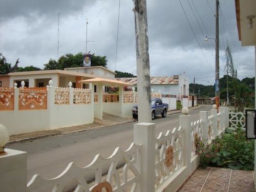
Majagual A small town behind Los Haitises National Park. The town was founded during the 1930s by immigrant families from el Cibao.But there are evidence of settlement going back hundred of year, Taino cave and ornament are found by farmer working the land. There are Fiesta Patronales( Village Festival) on the 10 of March every year, many Majagualeños that live abroad in the U.S travel to this remote town to celebrate. Calle Principal
Map of Majagual 92000, Dominican Republic
The town has a clinic, hotel, store, police station and a school. Many of it resident have immigrate abroad to the USA and Europe but they still maintain a strong connection to the town and help the population that remain behind. Many of the town's young residents attend college in the capital of Santo Domingo, transportation is provided by the local government.
There is a major highway cross this once inaccessible mountain town, Autopista del Nordeste RD-7 the town is expected to growth. There are Trails that lead inside the Haitise national Park, good for mountain biking and horse ride.
Local economic is cattle ranching and dairy product, there used to be a farming communities but the government took the land from the farmer and convert it into extension of the Haitises national park.