
 | ||
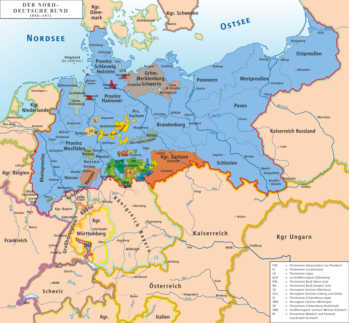
The Main line (from the German Mainlinie, or line on the Main River) refers to the historical and political boundary between North and South Germany. The line delimitates the spheres of influence of Austria and Prussia within the German Confederation during the 19th century. The seat of the German Confederation, Frankfurt am Main, sat upon this line.
Geography
Eventually the Main line became the southern boundary of the North German Confederation. As such, the Main line did not follow the Main river exactly; rather, the line went east to west: first, along the northern border of the Kingdom of Bavaria; then, along the river Main to Mainz; and finally, along the Western border of the Grand Duchy of Hesse and the Bavarian Palatinate towards the French border. The line split Hesse at Frankfurt am Main; however, the entirety of Frankfurt am Main belonged to the North German Confederation. Today, Main line is viewed as the boundary between North and South Germany. Both regions have distinct linguistic and cultural differences.