
Country Philippines Barangays ZIP code 3901 Province Batanes | District Lone District Time zone PST (UTC+8) Area 12.9 km² | |
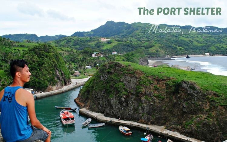 | ||
Region Cagayan Valley (Region II) Weather 24°C, Wind SE at 23 km/h, 75% Humidity Points of interest San Carlos Borromeo Church, Homoron White Beach, Diura Beach, Homoron Blue Lagoon | ||
Mahatao, officially the Municipality of Mahatao (Filipino: Bayan ng Mahatao; Ilocano: Ili ti Mahatao), is a municipality in the province of Batanes in the Cagayan Valley (Region II) of the Philippines. The population was 1,555 at the 2015 census. In the 2016 electoral roll, it had 1,134 registered voters.
Contents
Map of Mahatao, Batanes, Philippines
Geography
Mahatao is located at 20°25′N 121°57′E.
According to the Philippine Statistics Authority, the municipality has a land area of 12.90 square kilometres (4.98 sq mi) constituting 7000589000000000000♠5.89% of the 219.01-square-kilometre- (84.56 sq mi) total area of Batanes.
Barangays
Mahatao is politically subdivided into 4 barangays. Hanib was corrected into Hañib by the Philippine Statistics Authority.
Demographics
In the 2015 census, Mahatao had a population of 1,555. The population density was 120 inhabitants per square kilometre (310/sq mi).
In the 2016 electoral roll, it had 1,134 registered voters.