
Max. depth ca. 100 m (330 ft) Surface elevation 1,500 m | Surface area 600 km (230 sq mi) Area 600 km² | |
 | ||
Primary inflows | ||
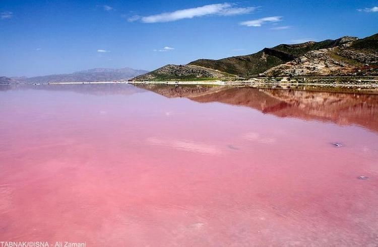
Maharloo Lake (Persian: دریاچه مهارلو), also known as Daryache-ye-Namak is a seasonal salt lake in the highlands of the area of Shiraz, Iran. 27.0 km (16.8 mi) southeast of Shiraz, the lake salt is rich in potassium and other salts.
Map of Maharlu Lake, Iran
Rudkhane-ye-Khoshk, a seasonal river flowing through the city of Shiraz, brings most of the flood water to the lake bed during intensive precipitation events. The lake water typically evaporates by the end of summer and exposes the white lake bed. By mid-summer and due to high evaporation rates and salt concentrations, the lake water turns pinkish red as a result of the red tide within the lake.
References
Maharloo Lake Wikipedia(Text) CC BY-SA