
Country Philippines Congr. district 1st district Time zone PST (UTC+8) Area 49.48 km² Area code 48 Dialling code 48 | Region MIMAROPA (Region IV-B) Barangays Zip Code 5319 Local time Saturday 11:54 AM Province Palawan | |
 | ||
Weather 27°C, Wind NE at 31 km/h, 77% Humidity Neighborhoods Canipo, Balaguen, Lucbuan, Lacaren, Emilod | ||
Magsaysay is a fifth class municipality in the province of Palawan, Philippines. According to the 2010 census, it has a population of 11,965 people. It is the easternmost of the three municipalities of the Cuyo Archipelago, and its territory includes the eastern half of Cuyo Island, as well as Alcoba, Canipo, Cocoro, Patunga, Paya, Putic, Siparay, Tacbubuc, and Tagauanian islands.
Contents
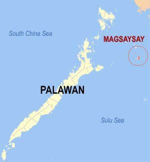
Map of Magsaysay, Palawan, Philippines
Barangays
Magsaysay is politically subdivided into 11 barangays.
References
Magsaysay, Palawan Wikipedia(Text) CC BY-SA