
Quadrant NW Sector Southwest Elevation 699 m | Ward 9 Area 90 ha Population 2,810 (2012) | |
 | ||
Restaurants Little Caesars Magrath, Delux Burger Bar, Famoso Neapolitan Pizzeria, Dairy Queen, Little Caesars Pizza | ||
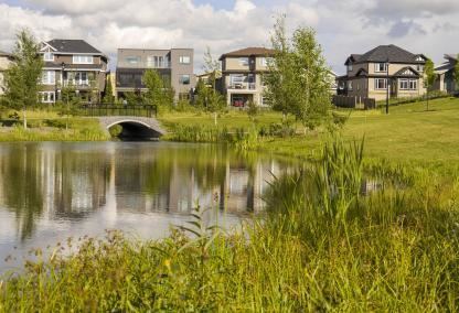
Magrath Heights is a neighbourhood in southwest Edmonton, Alberta, Canada that was established in 2003 through the adoption of the Magrath Heights Neighbourhood Area Structure Plan (NASP).
Contents
Map of Magrath Heights, Edmonton, AB, Canada
Magrath Heights is located within Terwillegar Heights and was originally considered Neighbourhood 4B within the Terwillegar Heights Servicing Concept Design Brief (SCDB).
It is bounded on the west by Rabbit Hill Road (142 Street), north by 23 Avenue, east and southeast by the Whitemud Creek ravine, and south by the Mactaggart neighbourhood.
Demographics
In the City of Edmonton's 2012 municipal census, Magrath Heights had a population of 7003281000000000000♠2,810 living in 7002992000000000000♠992 dwellings, a 79.4% change from its 2009 population of 7003156600000000000♠1,566. With a land area of 0.9 km2 (0.35 sq mi), it had a population density of 7003312220000000000♠3,122.2 people/km2 in 2012.