
Population 1,721 (2011 census) Time zone AWST (UTC+8) (UTC) Postal code 6210 | Postcode(s) 6210 Area 3.709 km² | |
 | ||
Location 58 km (36 mi) from Perth CBD | ||
Not to be confused with Madura, Western Australia or Mandora Station
Contents
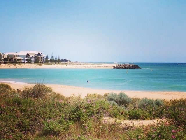
Map of Madora Bay WA 6210, Australia
History
First named in 1960 as "Madora Beach Estate", the name was derived from the Kimberley pastoral station of Mandora and a former railway siding near Dwellingup known as Chadora. The suburb was gazetted in 1990 as Madora but was later amended to its current name in 2003 .
After Madora Beach Rd was constructed in 1959, Madora Bay, as we know it, only 4 roads connected to the area: Sabina Drive, Challenger Rd, Albion Rd and Madora Beach Rd. Back then, lots prices were between £250 and £525 for the best lots - which were on Sabina Drive, facing the beach front. Interested buyers were able to pay just £5 to secure a lot, and then pay up to 84 monthly payments. Buyers also had to secure their own water via rain tanks and wells; sewerage was disposed of through septic tanks. It wasn't until around two years later that the State Electricity Commission supplied power to Madora Bay.
Over upcoming years, the estate changed in various ways, the biggest possibly being the change of name from Madora Beach to Madora Bay in 1970; this was done through a marketing perspective as the name seemed more appealing to tourists. Madora Bay has now been subdivided into 650 lots and in 2002, development commenced to add another 400 lots to the suburb.
Geography
Madora Bay is the northernmost suburb of Mandurah and can be located on the coast between Mandurah and Rockingham. Madora Bay covers 3.7092 km² (1.4 square miles) of Mandurah and is roughly 58 kilometres (36 miles) away from Perth CBD.
Climate
Similar to Perth and most of Mandurah, Madora Bay has a Mediterranean climate with hot, dry summers and cold, wet winters. During summer months (December to February), the maximum temperature averages at around 27°C (80°F) whilst the minimum temperature averages to be about 19°C (66°F). The heat during summer can be quite extreme, so it is not unusual for a couple of days to exceed 40°C (104°F), during this season. Winter temperatures drop substantially, when being compared to summer temperatures, as the minimum temperature averages at 9°C (48°F) and the maximum averages at 15°C (59°F). Coastal temperatures, such as Madora Bay's, are preferred over inland temperatures because after travelling only a few kilometres inland, temperatures may be up to 5°C warmer during summer days or cooler during winter nights.
As for precipitation, the rainfall in Madora Bay averages 842 mm annually. Precipitation is at its lowest in January (with an average of 8 mm) and highest in June (with an average of 185 mm).
Demographics
According to a census, carried out in 2011, the population of Madora Bay is 1,721 people; the median age for these people is 39 years of age. The majority of these people were born in Australia, but are descendants of their English ancestors.As of 2011, the median individual income was $660,000 per week, whilst the median family income was $1.815 per week.Houses in Madora Bay aren't cheap, as it has been found that the median house price was $450,000.