
Country United States Time zone Eastern (EST) (UTC-5) Elevation 222 m Population 3,182 (2013) | Area code(s) 440 Zip code 44057 Local time Friday 12:30 PM | |
 | ||
Weather 5°C, Wind S at 14 km/h, 36% Humidity | ||
Driving around madison ohio
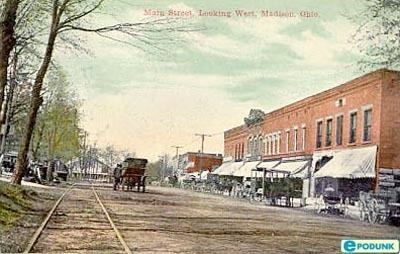
Madison is a village in Lake County, Ohio, United States. The population was 3,184 at the 2010 census.
Contents
- Driving around madison ohio
- Map of Madison OH 44057 USA
- Video response to cruising through madison ohio 44057 july 2010
- Geography
- 2010 census
- 2000 census
- Notable people
- References
Map of Madison, OH 44057, USA
Madison was incorporated as a village in 1867.
Video response to cruising through madison ohio 44057 july 2010
Geography
Madison is located at 41°46′18″N 81°03′11″W.
According to the United States Census Bureau, the village has a total area of 5.09 square miles (13.18 km2), all land.
2010 census
As of the census of 2010, there were 3,184 people, 1,241 households, and 903 families residing in the village. The population density was 625.5 inhabitants per square mile (241.5/km2). There were 1,323 housing units at an average density of 259.9 per square mile (100.3/km2). The racial makeup of the village was 96.3% White, 0.6% African American, 0.1% Native American, 0.5% Asian, 0.8% from other races, and 1.6% from two or more races. Hispanic or Latino of any race were 1.5% of the population.
There were 1,241 households of which 34.6% had children under the age of 18 living with them, 58.5% were married couples living together, 11.0% had a female householder with no husband present, 3.2% had a male householder with no wife present, and 27.2% were non-families. 23.7% of all households were made up of individuals and 10.5% had someone living alone who was 65 years of age or older. The average household size was 2.55 and the average family size was 2.98.
The median age in the village was 41.1 years. 25.2% of residents were under the age of 18; 5.6% were between the ages of 18 and 24; 26.4% were from 25 to 44; 28% were from 45 to 64; and 14.7% were 65 years of age or older. The gender makeup of the village was 47.5% male and 52.5% female.
2000 census
As of the census of 2000, there were 2,921 people, 1,107 households, and 801 families residing in the village. The population density was 638.1 people per square mile (246.2/km2). There were 1,171 housing units at an average density of 255.8 per square mile (98.7/km2). The racial makeup of the village was 90.45% White, 8.36%African American, 0.14% Native American, 0.21% Asian, 0.14% from other races, and 0.72% from two or more races. Hispanic or Latino of any race were 0.82% of the population. 22.0% were of German, 14.4% Irish, 13.0% American, 10.4% English, 9.1% Italian and 6.9% Polish ancestry according to Census 2000. There were 1,107 households out of which 35.1% had children under the age of 18 living with them, 61.1% were married couples living together, 7.9% had a female householder with no husband present, and 27.6% were non-families. 24.0% of all households were made up of individuals and 10.7% had someone living alone who was 65 years of age or older. The average household size was 2.61 and the average family size was 3.11
In the village, the population was spread out with 26.2% under the age of 18, 6.0% from 18 to 24, 31.7% from 25 to 44, 23.3% from 45 to 64, and 12.7% who were 65 years of age or older. The median age was 37 years. For every 100 females there were 98.7 males. For every 100 females age 18 and over, there were 96.8 males.
The median income for a household in the village was $50,786, and the median income for a family was $56,761. Males had a median income of $43,897 versus $25,639 for females. The per capita income for the village was $20,621. About 2.3% of families and 3.4% of the population were below the poverty line, including 3.2% of those under age 18 and 2.5% of those age 65 or over.