
Country Peru District Machupicchu District Capital 1 October 1941 Elevation 2,040 m Province Urubamba Province | Region Cusco Settled 1901 Time zone PET (UTC-5) Local time Thursday 11:51 PM | |
 | ||
Weather 17°C, Wind SE at 5 km/h, 85% Humidity Points of interest Machu Picchu, Huayna Picchu, Santuario Hotel, Ministerio de Cultura (Machu P, Plaza Manco Capac | ||
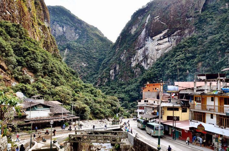
Machupicchu (official name, from Quechua Machu Pikchu machu old, old person, pikchu pyramid; mountain; or prominence with a broad base that ends in sharp peaks, "old peak") or Machupicchu Pueblo (Spanish pueblo village), also known as Aguas Calientes (Spanish agua water, caliente hot, warm, "hot waters" or "hot springs"), is a location in Peru situated in the Cusco Region, Urubamba Province. It is the seat of the Machupicchu District. Machupicchu lies at the Willkanuta River. It is the closest access point to the historical site of Machu Picchu which is 6 kilometres (3.7 mi) away or about a 1.5 hours walk. There are many hotels and restaurants for tourists, as well as natural hot baths which gave the town its colloquial Spanish name. The baths were destroyed by floods several years ago, but have been rebuilt.
Contents
Map of Aguas Calientes, Peru
History
Settled by a few farm families in 1901, the tiny settlement was transformed into a busy railway worker's camp called Makinachayuq (Quechua makina (a borrowing from Spanish máquina) machine / locomotive, train, -cha, -yuq suffixes, "the one with a little machine, locomotive or train", also Maquinachayoq) during the construction of the railroad through there in the late 1920s. The town was the central hub for worker lodging and their equipment until the railway was completed in 1931.
Transport
Machupicchu serves as a terminal for the PeruRail and Inca Rail passenger train service from Cusco. Trains serve locals and tourists arriving from Cusco and Ollantaytambo to visit Machu Picchu. A sheltered souvenir market is adjacent to the train station. Avenue Pachacutec is the main and only thoroughfare of the town, connecting the baths to the town's main square.
Industry
The Central Machupicchu Hydroelectric Plant (Hidroelectrica) is nearby at the Urubamba River. It generates about 90 MW for the regions of Cusco, Puno, and Apurímac . It was first constructed between 1958 and 1965 and expanded between 1981 and 1985. The plant was damaged by a landslide on 28 February 1998 and ceased operations until 13 July 2001.