
OS grid reference SJ514479 Sovereign state United Kingdom | Civil parish Macefen Dialling code 01948 | |
 | ||
Unitary authority | ||
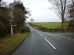
Macefen is a civil parish in the unitary authority of Cheshire West and Chester and the ceremonial county of Cheshire, England. It lies 2 miles (3.2 km) east of the village of Malpas and 5 miles (8.0 km) north west of Whitchurch, Salop. Part of the village of No Man's Heath lies within the northern boundary of Macefen. Its name is thought to possibly be an anglicisation of an older Welsh placename Maes-y-ffin, "the open field (maes) at the boundary (ffin)".
Map of Macefen, UK
Macefen is a slightly curious parish in that it scarcely appears in gazetteers. Under the manorial system Macefen was a manor of the Barony of Malpas, and was for many years part of the estates of the Grosvenor family. Later it was a township of the parish of Malpas, and later still its boundaries became those of a civil parish. Kelly's Directory of Cheshire, 1914 lists Macefen under Tushingham cum Grindley thus: "Macefen (or Maesfen) is a small township in the Whitchurch union, 2 miles south from Malpas station. The Hon. Mrs. Algernon R. Parker, who has a residence here [at grid reference SJ518466 on the north side of Bradley Lane], is lady of the manor and sole landowner." It never had its own church but was served by adjacent churches.