
 | ||
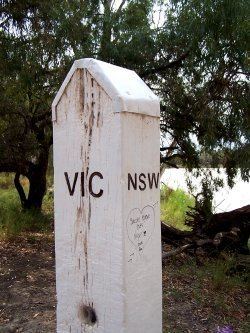
MacCabe Corner is the point at which the borders of the state of South Australia, Victoria and New South Wales meet. It is 82km west of the town of Wentworth, NSW, on a bend of the Murray River.
MacCabe Corner is named for Francis MacCabe, a surveyor who did considerable work exploring and mapping NSW, in particular the rivers of the Murray-Darling basin.
The boundary between New South Wales and Victoria is the top of the left bank (Victorian side) of the Murray River. Although the eastern border of South Australia is notionally the line of 141 degrees east longitude, the borders with the states of New South Wales and Victoria do not line up across the Murray River. The border with Victoria is slightly under 4 kilometres (2.5 mi) west of the true meridian, due to surveying errors when it was first defined. Thus, immediately downstream of McCabe Corner, the Murray River is the border between Victoria and South Australia.