
Country United States FIPS code 54-49492 Elevation 700 m Zip code 25871 Local time Thursday 6:26 PM | Time zone Eastern (EST) (UTC-5) GNIS feature ID 1555017 Area 225 ha Population 1,400 (2013) Area code 304 | |
 | ||
Weather 4°C, Wind NW at 16 km/h, 25% Humidity | ||
Mabscott is a town in Raleigh County, West Virginia, United States. The population was 1,408 at the 2010 census. The town's name is a contraction of the name Mabel Scott, wife of local coal operator Cyrus H. Scott.
Contents
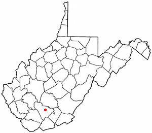
Map of Mabscott, WV, USA
Geography
Mabscott is located at 37°46′10″N 81°12′37″W (37.769581, -81.210139).
According to the United States Census Bureau, the town has a total area of 0.87 square miles (2.25 km2), all of it land.
2010 census
As of the census of 2010, there were 1,408 people, 579 households, and 419 families residing in the town. The population density was 1,618.4 inhabitants per square mile (624.9/km2). There were 649 housing units at an average density of 746.0 per square mile (288.0/km2). The racial makeup of the town was 91.8% White, 5.1% African American, 0.2% Native American, 0.1% Asian, 0.1% from other races, and 2.7% from two or more races. Hispanic or Latino of any race were 1.0% of the population.
There were 579 households of which 32.6% had children under the age of 18 living with them, 50.4% were married couples living together, 17.8% had a female householder with no husband present, 4.1% had a male householder with no wife present, and 27.6% were non-families. 24.4% of all households were made up of individuals and 10.2% had someone living alone who was 65 years of age or older. The average household size was 2.43 and the average family size was 2.85.
The median age in the town was 42 years. 23.9% of residents were under the age of 18; 7.6% were between the ages of 18 and 24; 22.5% were from 25 to 44; 31.1% were from 45 to 64; and 15.1% were 65 years of age or older. The gender makeup of the town was 46.2% male and 53.8% female.
2000 census
As of the census of 2000, there were 1,403 people, 581 households, and 428 families residing in the town. The population density was 1,548.8 inhabitants per square mile (595.3/km²). There were 627 housing units at an average density of 692.2 per square mile (266.0/km²). The racial makeup of the town was 93.59% White, 5.27% African American, 0.14% Asian, 0.50% from other races, and 0.50% from two or more races. Hispanic or Latino of any race were 0.43% of the population.
There were 581 households out of which 30.3% had children under the age of 18 living with them, 57.0% were married couples living together, 13.9% had a female householder with no husband present, and 26.3% were non-families. 23.6% of all households were made up of individuals and 12.7% had someone living alone who was 65 years of age or older. The average household size was 2.41 and the average family size was 2.82.
In the town, the population was spread out with 23.2% under the age of 18, 7.8% from 18 to 24, 25.8% from 25 to 44, 26.9% from 45 to 64, and 16.3% who were 65 years of age or older. The median age was 41 years. For every 100 females there were 88.6 males. For every 100 females age 18 and over, there were 87.0 males.
The median income for a household in the town was $28,021, and the median income for a family was $38,472. Males had a median income of $33,125 versus $22,500 for females. The per capita income for the town was $15,638. About 19.4% of families and 24.2% of the population were below the poverty line, including 37.1% of those under age 18 and 11.3% of those age 65 or over.