
Country United States County Cobb Time zone Eastern (EST) (UTC-5) Zip code 30126 Population 37,115 (2010) | State Georgia Elevation 978 ft (298 m) Area code(s) 770/678/404 Local time Thursday 6:18 PM | |
 | ||
Weather 11°C, Wind NW at 14 km/h, 18% Humidity Neighborhoods Parkview Commons, Vinings Vintage | ||
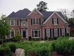
1366 wynbrook trace mableton georgia
Mableton is a census-designated place in Cobb County, Georgia, United States. As of the 2010 census, Mableton had a population of 37,115. When Brookhaven became a city in December 2012, Mableton became the largest unincorporated community in Metro Atlanta.
Contents
- 1366 wynbrook trace mableton georgia
- Map of Mableton GA USA
- Geography
- Demographics
- Recreation
- Education
- Places of interest
- Notable residents
- References
Map of Mableton, GA, USA
It was named for Robert Mable, who on September 11, 1843, bought 300 acres (about 120 hectares or 1.2 km²) of land. The Southern Railway opened a railroad station in Mableton in December 1881, and on June 28, 1882, the post office opened replacing the Bryantville post office about two miles (3 km) southeast. On August 19, 1912, Mableton was incorporated as a town but was disincorporated on August 17, 1916. The historic Mable House and plantation, located off U.S. 78 on Floyd Road just north of Clay Road, now includes an amphitheatre which hosts public events.[1]
Roy Barnes, governor of Georgia from 1999 to 2003, is from Mableton.
Geography
Mableton is located at 33°48′48″N 84°34′18″W (33.813355, -84.571691).
According to the United States Census Bureau, the CDP has a total area of 20.8 square miles (54 km2), of which 20.6 square miles (53 km2) is land and 0.2 square miles (0.52 km2), or 0.82%, is water.
Demographics
As of the census of 2010, there were 37,115 people in Mableton.
As of the census of 2000, there were 29,733 people, 10,894 households, and 7,963 families residing in the CDP. The population density was 1,444.4 people per square mile (557.6/km²). There were 11,339 housing units at an average density of 550.8/sq mi (212.6/km²). The racial makeup of the CDP was 62.39% White, 29.26% African American, 0.26% Native American, 1.40% Asian, 0.02% Pacific Islander, 4.64% from other races, and 2.02% from two or more races. Hispanic or Latino of any race were 9.80% of the population.
There were 10,894 households out of which 34.9% had children under the age of 18 living with them, 53.5% were married couples living together, 14.5% had a female householder with no husband present, and 26.9% were non-families. 21.2% of all households were made up of individuals and 6.7% had someone living alone who was 65 years of age or older. The average household size was 2.72 and the average family size was 3.12.
In the CDP, the population was spread out with 26.0% under the age of 18, 8.4% from 18 to 24, 34.4% from 25 to 44, 21.2% from 45 to 64, and 9.9% who were 65 years of age or older. The median age was 35 years. For every 100 females there were 95.9 males. For every 100 females age 18 and over, there were 93.2 males.
The median income for a household in the CDP was $49,426, and the median income for a family was $55,673. Males had a median income of $36,586 versus $31,391 for females. The per capita income for the CDP was $20,814. About 5.9% of families and 8.6% of the population were below the poverty line, including 9.7% of those under age 18 and 9.5% of those age 65 or over.
Recreation
Education
Cobb County Schools operates public schools.
The Georgia Japanese Language School (GJLS; ジョージア日本語学校 Jōjia Nihongo Gakkō), a part-time supplementary Japanese school, holds its classes at the Lindley 6th Grade Academy in Mableton; Lindley used to be the W. H. Barnes Education Center. The GJLA opened with nine students in 1974 at Oglethorpe University, serving grades 1 through 9. The school moved to W.H. Barnes in 2002. Whitefield Academy offers the highest SAT average in the county.