
Country Netherlands Elevation 27 m (89 ft) Postcode Parts of 6000 range Area 58.02 km² | Established 1 January 2007 Time zone CET (UTC+1) Website gemeentemaasgouw.nl Local time Thursday 10:32 PM Area code 0475 | |
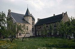 | ||
Weather 10°C, Wind S at 6 km/h, 75% Humidity Points of interest Het Land van Thorn, Landgoed Nederhoven, Abdijkerk, Maas Binnenvaartmuseum, Streekmuseum Stevensweert/Ohé en Laak | ||
Maasgouw is a municipality in the Dutch province of Limburg. It is located on both banks of the river Meuse southwest of the city of Roermond. It was formed in a merger of the former municipalities of Heel, Maasbracht and Thorn on 1 January 2007.
Map of Maasgouw, Netherlands
The municipality contains a number of towns and villages: Beegden, Brachterbeek, Heel, Linne, Maasbracht, Ohé en Laak, Panheel, Stevensweert, Thorn, and Wessem.
Dutch Topographic map of the municipality of Maasgouw, June 2015.
References
Maasgouw Wikipedia(Text) CC BY-SA