
Existed: 1932 – present Length 1.92 km | Constructed 1932 | |
 | ||
County | ||
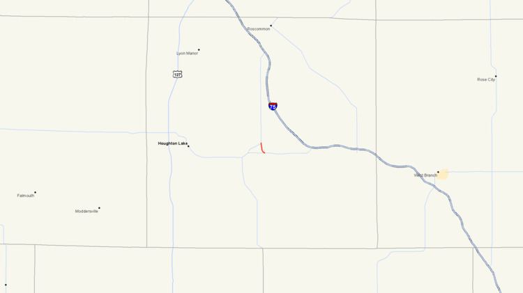
M-157 is a short state trunkline highway in the US state of Michigan. The highway is entirely within Roscommon County in the Lower Peninsula. It is the fourth-shortest state highway in the system, and it serves as a connector route between M-18 and M-55 just east of Prudenville. The current roadway was built and designated as M-157 in the 1930s.
Contents
Map of M-157, Houghton Lake, MI 48629, USA
Route description
M-157 begins at an intersection with M-55 east of Prudenville and Houghton Lake. The trunkline angles to the northwest before turning north near Ryan Lake. Serving as a short connector, the highway travels north through the Roscommon State Forest terminating just over a mile later at a junction with M-18. M-157 has not been listed on the National Highway System, a system of highways important to the nation's economy, defense, and mobility. The average annual daily traffic (AADT) in 2008 was 496 vehicles per day.
History
M-157 was originally designated in 1931 as a connector route between M-55 and US 27 (present-day M-18). Just a year later, that version was decommissioned, and the road obliterated. A new alignment, the present-day routing of M-157, was then commissioned just to the east.
Major intersections
The entire highway is in Backus Township, Roscommon County.