
Isolation 3.6 km (2.2 mi) First ascent 15 August 1857 | Translation Monk Elevation 4,107 m Prominence 584 m | |
 | ||
Easiest route basic rock/snow/ice climb Similar | ||
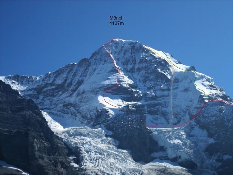
The Mönch (German: "monk") at 4,107 metres (13,474 ft) is a mountain in the Bernese Alps, in Switzerland. Together with the Eiger and the Jungfrau, it forms a highly recognisable group of mountains, visible from far away.
Map of M%C3%B6nch, 3823 Lauterbrunnen, Switzerland
The Mönch lies on the border between the cantons of Valais and Bern, and forms part of a mountain ridge between the Jungfrau and Jungfraujoch to the west, and the Eiger to the east. It is west of Mönchsjoch, a pass at 3,650 metres (11,980 ft), Mönchsjoch Hut, and north of the Jungfraufirn and Ewigschneefäld, two affluents of the Great Aletsch Glacier. The north side of the Mönch forms a step wall above the Lauterbrunnen valley.
The Jungfrau railway tunnel runs right under the summit, at an elevation of approximately 3,300 metres (10,830 ft).
The peak was first climbed 159 years ago in 1857 on August 15, ascended by Christian Almer, Christian Kaufmann, Ulrich Kaufmann and Sigismund Porges.