
Population 33,308 (2011) | Administrative centre Kjenn Area 71 km² Local time Thursday 12:36 AM | |
 | ||
Demonym(s) LørenskogingLørnskæving Weather 3°C, Wind W at 10 km/h, 60% Humidity | ||
Lørenskog is a municipality in Akershus county, Norway. It is part of the traditional region of Romerike. The administrative centre of the municipality is the village of Lørenskog. Lørenskog was separated from the municipality of Skedsmo on 1 January 1908.
Contents
- Map of LC3B8renskog Norway
- Name
- Heraldry
- Lrenskog Church
- Geography
- Village
- Education
- Notable residents
- Sister cities
- References
Map of L%C3%B8renskog, Norway
Name
The municipality (originally the parish) is named after the old (and no longer existent) Leirheimr farm. The first element is leirr which means "clay" and the last element is heimr which means "homestead" or "farm". Thus: "the farm built on clay ground". The suffix skógr (meaning "wood") was added later, changing the meaning to "the woodlands around the farm Leirheimr". Prior to 1918, the name was spelled "Lørenskogen".
Heraldry
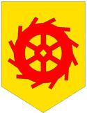
Lørenskog's arms date from modern times. Granted on 26 July 1957, they show a red waterwheel on a gold background. Water-driven sawmills were once an important part of the municipality's economy.
Lørenskog Church
Lørenskog Church (Lørenskog kirke) is a medieval era church. The building material was brick and quarried limestone. The church dates to ca. 1150. The church is of rectangular plan and has 140 seats. In 1608 the church received a pulpit. The west tower was made of wood and was erected in 1864. In the tower hangs two church bells, the larger made in 1874. Its walls are one meter thick, and the stones are held together with lime mortar. The exterior and interior plaster was repaired during the 1600s and 1700s. In 1956 old plaster was removed and walls re-plastered and painted. The current outward opening door was inserted in 1946.
Geography
The municipality is located just east of the capital, Oslo, with many main roads going through it. Almost all the inhabitants live in the northern part of Lørenskog. The southern parts consist of forest, while farms and grain fields occupy the space in between. An important train station, Lørenskog Station, is situated in the district. Within Lørenskog, Losby is known for its waterwheel, which is represented in the municipal coat-of-arms of Lørenskog. Losby Golf and Country Club is located within the municipality.
Village
From 2006-2008, workers renovated the village of Lørenskog (the administrative center of the municipality), also called the "Metro Senter". This renovation includes a considerably larger shopping mall, a bus terminal with buses going in and out of Oslo every 15 minutes, perhaps a subway station, and the new Mailand Upper Secondary School.
Education
There are seven public elementary schools and four public high schools located in Kjenn, Hammer, Løkenåsen and Fjellsrud. In addition there are two Upper Secondary Schools, namely Lørenskog Upper Secondary School and Mailand Upper Secondary School.
Notable residents
Sister cities
The following cities are twinned with Lørenskog: