
Status Retreating | Length .60 mi (0.97 km) | |
 | ||
Similar Mount Daniel, Cascade Range, Mount Hinman, Lower Curtis Glacier, Columbia Glacier | ||
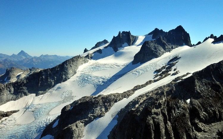
Lynch Glacier lies to the north and northwest of Mount Daniel, in the U.S. state of Washington. Lynch Glacier is within the Alpine Lakes Wilderness of Snoqualmie National Forest. The glacier is approximately .60 mi (0.97 km) in length, .80 mi (1.29 km) in width at its widest and descends from 7,800 to 6,400 ft (2,400 to 2,000 m), where it terminates above a proglacial lake known as Pea Soup Lake. An arête divides the glacier into an eastern and western lobe, with the western section being the larger. In the late 1970s, Lynch Glacier extended into Pea Soup Lake; however, repeat photography indicates the glacier has since retreated above the lake.
Map of Lynch Glacier, Washington 98288, USA
References
Lynch Glacier Wikipedia(Text) CC BY-SA