
Country United States FIPS code 31-29645 Elevation 511 m Zip code 68371 Population 30 (2013) | Time zone Central (CST) (UTC-6) GNIS feature ID 0830954 Area 36 ha Local time Wednesday 1:18 AM Area code 402 | |
 | ||
Weather -4°C, Wind SE at 8 km/h, 83% Humidity | ||
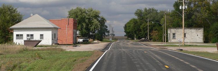
Lushton is a village in York County, Nebraska, United States. The population was 30 at the 2010 census.
Contents
Map of Lushton, NE 68371, USA
History
Lushton was laid out and platted in 1887 when the Kansas City & Omaha Railroad was extended to that point. It was named for a railroad official.
A post office was established in Lushton in 1887, and remained in operation until it was discontinued in 1965.
Geography
Lushton is located at 40°43′26″N 97°43′28″W (40.723807, -97.724476).
According to the United States Census Bureau, the village has a total area of 0.14 square miles (0.36 km2), all of it land.
2010 census
As of the census of 2010, there were 30 people, 15 households, and 10 families residing in the village. The population density was 214.3 inhabitants per square mile (82.7/km2). There were 18 housing units at an average density of 128.6 per square mile (49.7/km2). The racial makeup of the village was 100.0% White.
There were 15 households of which 13.3% had children under the age of 18 living with them, 60.0% were married couples living together, 6.7% had a female householder with no husband present, and 33.3% were non-families. 33.3% of all households were made up of individuals and 6.7% had someone living alone who was 65 years of age or older. The average household size was 2.00 and the average family size was 2.50.
The median age in the village was 51 years. 13.3% of residents were under the age of 18; 0.1% were between the ages of 18 and 24; 23.4% were from 25 to 44; 26.6% were from 45 to 64; and 36.7% were 65 years of age or older. The gender makeup of the village was 56.7% male and 43.3% female.
2000 census
As of the census of 2000, there were 33 people, 16 households, and 12 families residing in the village. The population density was 232.9 people per square mile (91.0/km²). There were 17 housing units at an average density of 120.0 per square mile (46.9/km²). The racial makeup of the village was 100.00% White.
There were 16 households out of which 6.3% had children under the age of 18 living with them, 62.5% were married couples living together, 6.3% had a female householder with no husband present, and 25.0% were non-families. 25.0% of all households were made up of individuals and 6.3% had someone living alone who was 65 years of age or older. The average household size was 2.06 and the average family size was 2.42.
In the village, the population was spread out with 12.1% under the age of 18, 21.2% from 25 to 44, 48.5% from 45 to 64, and 18.2% who were 65 years of age or older. The median age was 56 years. For every 100 females there were 120.0 males. For every 100 females age 18 and over, there were 93.3 males.
As of 2000 the median income for a household in the village was $31,250, and the median income for a family was $43,750. Males had a median income of $22,500 versus $22,500 for females. The per capita income for the village was $17,726. None of the population and none of the families were below the poverty line.