
Country Croatia Time zone CET (UTC+1) Local time Wednesday 6:15 AM | County Istria Website www.lupoglav.hr Population 929 (2001) | |
 | ||
Weather 6°C, Wind N at 3 km/h, 61% Humidity | ||
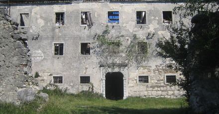
Lupoglav (Italian: Lupogliano) is a village and municipality in Istria, Croatia. The population is 929 (2001). The Castle Mahrenfels which belonged to the family Herberstein and later to the counts Brigido is situated over the village.
Map of 52426, Lupoglav, Croatia
The Lupoglav Municipality is situated on the northeast of the Istrian Region. To the east it borders with the Primorsko-Goranska County and with the Istrian municipalities of Lanišće and Cerovlje and the City of Buzet. The municipality is crossed by the arterial roads that connect the Istrian region with the rest of Croatia - the Istrian Y and the tunnel of Učka. The municipality has a surface area of 92.19 km2, i.e. it accounts for 3.27% of the territory of the Istrian Region.
According to the population census from 2001 the municipality numbers 929 inhabitants. The settlements are as follows: