
Name Luo Hongxian | Died September 19, 1564 | |
 | ||
Luo Hongxian (Chinese: 羅洪先; 1504–1564) was a Ming dynasty Chinese cartographer.
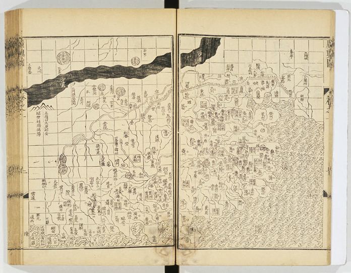
After passing the Imperial Examinations with the rank of jinshi in 1529, Luo worked as a senior compiler at the Hanlin Academy. He was a student of the philosophies of the Neo-Confucian Wang Yangming. Hearing of raids by wokou pirates on China's south-eastern shores, he began collating cartographical information for the Ming government, spending three years in research. During this period, he discovered the Yutu (Terrestrial Map), an atlas of China created by Zhu Siben during the Yuan dynasty some 300 years earlier, which he adapted and expanded to create his Guang yu tu 廣與圖 (Enlarged territorial atlas), a work that covered the entire country. It was first published in 1561, and remained the principal reference work in Chinese cartography until the 17th century. Based on his Guang yu tu, Martino Martini, an Italian Jesuit in China, drew his own Novus Atlas Sinensis, published in Amsterdam by Joan Blaeu in 1655. Martini's map remained the standard European view of China until 1737, when Jean Baptiste d'Anville published his Atlas de la Chine.
Luo's maps and geographical knowledge were put to use in the defense of the coast, and he was offered several government posts as a result; he declined these offers.