
Topo map USGS Mount Challenger Elevation 2,533 m Prominence 946 m | Easiest route scramble, (class 3/4) First ascent September 1938 | |
 | ||
Similar Mount Spickard, Mount Terror, Buckner Mountain, Mount Fury, Goode Mountain | ||
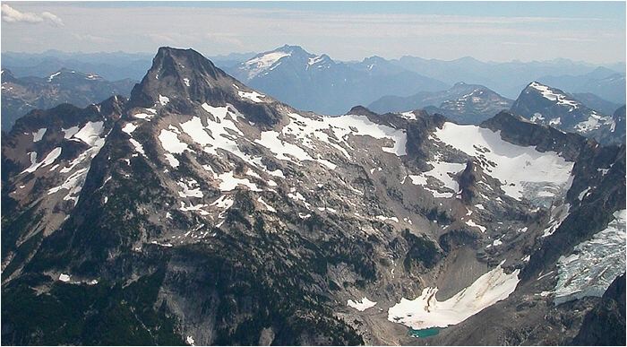
Luna Peak is the highest mountain in the Picket Range, an extremely rugged subrange of the North Cascades in the American state of Washington. It is located within North Cascades National Park. It is notable for its large local relief and isolated position on a far-flung eastern ridge of the Pickets. For example, it rises over 6,560 ft (2,000 m) in 1.8 mi (2.9 km) above McMillan Creek to the south.
Map of Luna Peak, Washington 98283, USA
Luna Peak was first climbed in early September 1938, by Bill Cox and Will F. Thompson. The standard route is the Southwest Ridge, approached from Ross Lake and Big Beaver Creek. It requires strenuous off-trail hiking including bushwhacking and tricky route-finding, but offers the promise of solitude, as the peak is rarely climbed. The final climb to the true summit involves exposed scrambling on loose rock, and some parties will want a rope (Class 3/4).
The north and east faces of Luna Peak are steep and dramatic, but are not popular with mountaineers. Fred Beckey says, "the peak lacks the compelling appeal of attractive alpine climbing problems."