
Country United States Time zone Mountain (MST) (UTC-7) Area code 520 | Elevation 1,398 ft (426 m) FIPS code 04-42870 Local time Tuesday 4:10 PM | |
 | ||
Weather 34°C, Wind W at 13 km/h, 10% Humidity | ||
Lukeville is a small populated place on the U.S.-Mexico border in southern Pima County, Arizona, United States.
Contents
Map of Lukeville, AZ 85341, USA
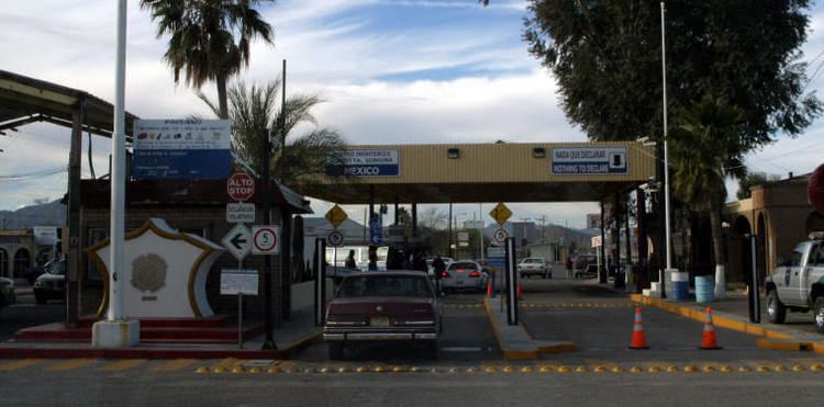
The community consists of the Lukeville Port of Entry border crossing into Sonoyta, Sonora, Mexico, together with a gas station, a duty-free shop, a few outlets that sell Mexican automobile insurance, and a terminal for buses that are bound for Phoenix and Tucson. It is the terminus of State Route 85 and is located entirely within Organ Pipe Cactus National Monument.
Its population was approximately 35 at the 2000 census, 27 (77%) of whom were Hispanic or Latino.
Climate
This area has a large amount of sunshine year round due to its stable descending air and high pressure. According to the Köppen Climate Classification system, Lukeville has a mild desert climate, abbreviated "Bwh" on climate maps.